| Directions
Take Exit 20
from I-87 and go north on US 9 for 1/2 mile. Take a
right on NY 149 and travel for 6.0 miles. At that
point, turn left on the Buttermilk Falls Road. Continue
straight on Buttermilk Falls Road for 6.9 miles (the
name of the road will change to Sly Pond Rd and it will
turn into a dirt road but just keep going straight).
At this point the falls will be on your left, look for
a place to safely park long the road. Note that
this is on route to the Shelving Rock Falls area.
|
| County: |
Washington |
| Town: |
Fort Ann |
| USGS Map: |
Putnam Mt |
| Waterway: |
Mount Hope
Brook |
| Latitude: |
N 43°
29' 44.376" |
| Longitude: |
W 73°
34' 0.48" |
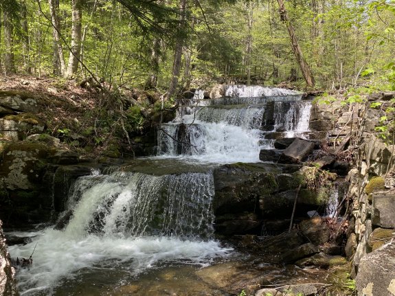
| Drop: |
~ 15' |
| Type: |
Cascade |
| Region: |
Off NY 149
west of Fort Ann |
| Parking: |
Roadside |
| Trail type: |
Dirt |
| Length of
hike: |
Roadside |
| Difficulty: |
Easy |
| Accessibility: |
Private |
| Name: |
Unnamed |

|
If you reach Miller Way, you have gone too far!
This falls is located along the left side Sly Pond Road, about 150 yards south of where Miller Road intersects. It is on Mount Hope Brook that flows out of Crossett Pond.
If you reach Miller Way, look for
Mount Hope
Brook Upper Falls at that intersection. Then
back-track to find this one.
Mount Hope Brook flows through Lake Pond and then continues
where it joins South Bay Creek before emptying into Ssuth Bay at
the head of Lake Champlain. The flow then goes north through Canada on the Richelieu River and
empties into the St. Lawrence River.
Last update: September 23, 2025
|