| County: |
Washington |
| Town: |
Fort Ann |
| USGS Map: |
Putnam Mt |
| Waterway: |
Mount Hope
Brook |
| Latitude: |
N 43°
29' 45.94" |
| Longitude: |
W 73°
34' 4.95" |
| Drop: |
~ 10' |
| Type: |
Cascade |
| Region: |
Off NY 149
west of Fort Ann |
| Parking: |
Roadside |
| Trail type: |
Dirt |
| Length of
hike: |
Roadside |
| Difficulty: |
Easy |
| Accessibility: |
Private |
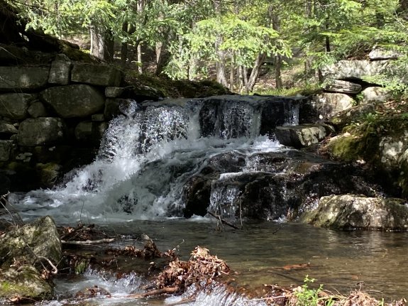
| Name: |
Unnamed |

|
This drop is just upstream of
Mount Hope Brook
Falls. It is at the side of the road where Miller Way and Sly Pond road intersect, on the south side of Miller
Way. It is private property but
we parked on Sly Pond Road to snap the photo.
Mount Hope Brook flows through Lake Pond and then continues
where it joins South Bay Creek before emptying into Ssuth Bay at
the head of Lake Champlain. The flow then goes north through Canada on the Richelieu River and
empties into the St. Lawrence River.
Last update: July 3, 2025
|