| Directions
This drop is located a short distance upstream from
Schumann Preserve Waterfall. From the base of
that drop, continue on the Blue loop trail for
approximately 300 yards until you reach the stream
crossing at the top of Schumann Preserve Waterfall.
|
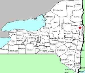
| County: |
Washington |
| Town: |
Fort Ann |
| USGS Map: |
Putnam Mt |
| Waterway: |
Unnamed
waterway |
| Latitude: |
N 43°
28' 00" |
| Longitude: |
W 73° 36'
35" |
| Drop: |
12' - 15' |
| Type: |
Ribbon Cascade |
| Region: |
Off NY 149
west of Fort Ann |
| Parking: |
Unpaved parking
area |
| Trail type: |
Dirt |
| Length of
hike: |
0.8 mile,
one-way |
| Difficulty: |
Vigorous |
| Accessibility: |
Public |
| Name: |
Unnamed |
|
 https://youtube.com/shorts/T-tcgTktcNg https://youtube.com/shorts/T-tcgTktcNgTo get to Upper Falls #2, climb up the right side
embankment of Upper Falls #1 and find a safe place
to cross the stream over to the left side. Just a
few yards up from Upper Falls #1 you will be able to
look upstream and see Upper Falls #2. Walk up the
left side approximately 250 yards to Upper Falls #2.
It is an easy hike, however, about half way up I
had to swing a little wide to the left to avoid a
steep portion of the stream bank. Pick your path of
least resistance.
This is a flume type falls 12-15 feet tall
surrounded by beautiful moss.
This unnamed stream empties into Lake George at Warner Bay. The water
from this then flows through La Chute into Lake Champlain.
The flow then goes north through Canada on the Richelieu River and
empties into the St. Lawrence River.
Please note that the coordinates listed here are
approximates.
Webmaster's note: Our thanks to Gary Dilmore for the
information and pictures of this location.
Last update: July 17, 2026
|