| Directions
This waterfall is a continuation of the hike heading
upstream on Shelving Rock Brook South Tributary,
|
| County: |
Washington |
| Town: |
Fort Ann |
| USGS Map: |
Shelving Rock |
| Waterway: |
Shelving Rock
Brook Tributary |
| Latitude: |
N 43°
32' 47.004" |
| Longitude: |
W 73° 35'
13.2" |
| Drop: |
~ 10' |
| Type: |
Slide |
| Region: |
Off NY 149
west of Fort Ann |
| Parking: |
Unpaved |
| Trail type: |
Dirt |
| Length of
hike: |
NA |
| Difficulty: |
Moderate |
| Accessibility: |
Public |
| Name: |
Unnamed |

|
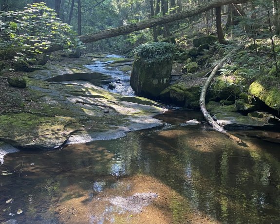
Continue a short distance upstream from
Shelving Rock Brook South Tributary Falls #5 and you will reach this
long slide. This site drops about ten feet over about a
100' section of the stream.
Notice on the picture that
the rock in the stream has a cool bunch of ferns growing on top
of it!Shelving Rock Brook empties into Lake George. The water
from this then flows through La Chute into Lake Champlain.
The flow then goes north through Canada on the Richelieu River and
empties into the St. Lawrence River.
Webmaster's note: Our thanks to Gary Dilmore for the
pictures, directions and information on this waterfall.
Last update: May 25, 2026
|