| Directions
This drop is in the same general area as
Shelving Rock Falls.
Follow directions in that entry and park in lot #2 if
you can. If not, park in lot 1 or 3 and walk to
lot 2.
|
| County: |
Washington |
| Town: |
Fort Ann |
| USGS Map: |
Shelving Rock |
| Waterway: |
Shelving
Rock Brook Middle Tributary |
| Latitude: |
N 43°
33' 25.128" |
| Longitude: |
W 73° 34'
42.564" |
| Drop: |
6' |
| Type: |
Slide |
| Region: |
Off NY 149
west of Fort Ann |
| Parking: |
Unpaved parking
area |
| Trail type: |
Dirt |
| Length of
hike: |
0.8 mile,
one-way |
| Difficulty: |
Moderate |
| Accessibility: |
Public |
| Name: |
Unnamed |

|
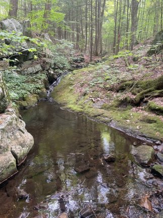
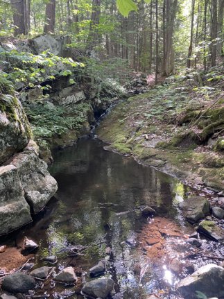
Out of the back end of Parking Lot #2 take the Big
Bridges Trail (Google maps calls it the Shelving Rock Brook
Trail) with blue trail markers for 0.9 mile. This trail is
an old road, pretty smooth, easy to follow and very little
elevation. At the end of
the Big Bridges trail, take a right on the Shortway Trail
(Google calls it Shelving Rock Mountain Trail) with yellow trail
markers. Follow this for 150 yards to a bridge that
crosses the Middle Tributary. This is where the off trail
adventure starts. Head upstream approximately 200 yards to
waterfall #1.
Please note that
the beginning of this hike will follow the instructions leading
you to the upper falls on the Shelving Rock Brook.Shelving Rock Brook empties into Lake George. The water
from this then flows through La Chute into Lake Champlain.
The flow then goes north through Canada on the Richelieu River and
empties into the St. Lawrence River.
Please note that the Shelving Rock Brook is
officially named but these tributaries and the falls on them are
unnamed. We have chosen these monikers to simplify the
cataloging of the waterfalls.
Webmaster's note: Our thanks to Gary Dilmore for the
information and pictures of this location.
Last update: September 18, 2025
|