| Directions
Take Exit 20 from I-87 and go north
on US 9 for 1/2 mile. Take a right on NY 149 and
travel for 6.0 miles. At that point, turn left
on the Buttermilk Falls Road. This will end at
a point where you merge left on the Sly Pond Road.
About 3.1 miles from this corner, you will reach a fork
where you should bear left. In another 0.8 mile,
there is another fork where you should bear right.
In another 2.6 miles, bear left at the next fork.
A little more than 2.3 miles from here, take the right
fork. A short distance from here, you will come
down a hill and cross Shelving Rock Brook. A sign
on your left indicates "Shelving Rock Falls 0.4
miles". Continue up the hill and there is
a parking area on the left.
|
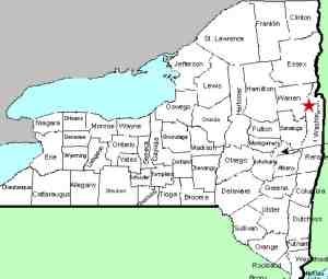
| County: |
Washington |
| Town: |
Fort Ann |
| USGS Map: |
Shelving Rock |
| Waterway: |
Shelving Rock
Brook |
| Latitude: |
N 43°
33' 11" |
| Longitude: |
W 73°
36' 09" |
| Drop: |
75' |
| Type: |
Classical
cascade |
| Region: |
Off NY 149
west of Fort Ann |
| Parking: |
Unpaved parking
area |
| Trail type: |
Dirt |
| Length of
hike: |
0.4 mile |
| Difficulty: |
Easy |
| Accessibility: |
Public |
| Name: |
Common |

|
 From the parking area,
walk back down the road about 0.1 mile to the trailhead. It
is actually 0.3 mile in to the top of the falls, another 0.1
mile or so to the base but well worth the walk.
Most of the trail is dirt, but after about 100 feet or so, the trail
goes through a section of about 50' that is cobble rocks and looks
like it is part of the river bed. It is likely that during
high water, this could be under water. As for the waterfall,
it is a beauty. It is something like you'd expect after a
significant Adirondack hike. From the parking area,
walk back down the road about 0.1 mile to the trailhead. It
is actually 0.3 mile in to the top of the falls, another 0.1
mile or so to the base but well worth the walk.
Most of the trail is dirt, but after about 100 feet or so, the trail
goes through a section of about 50' that is cobble rocks and looks
like it is part of the river bed. It is likely that during
high water, this could be under water. As for the waterfall,
it is a beauty. It is something like you'd expect after a
significant Adirondack hike.At the top of the falls there is
a concrete abutment. We're not sure what it is, why it is
there or how long it has been there. There are no signs of
a former mill or anything of that nature. Although it does
hold the level of the water above the falls a bit higher, it really
has no impact on the waterfall overall. The water drops about
two feet after coming over this and then begins its plunge down
the top of this waterfall. The upper part drops about eight feet
and then slides about 15' to the main cascade. Although not
a free-fall, this is a fairly vertical plunge.
From this crest, there is a trail that takes you down a section
of natural rock steps to the base of the falls and right into the
creek. Below this main drop, the channel winds around and
continues to drop. The first two drops are pretty little plunges.
The second of these would be a nice little waterfall on its own.
Below here are several more small steps. The level of the
creek probably drops another 50 or so feet through this section.
This entire area has many DEC signs and is a wilderness camping
area. We were amazed at, despite the remoteness of this region,
the traffic we saw while here. By the way, if you like to
listen to music when you travel, local radio stations are the order
of the day here. The satellite radio didn't receive anything
during most of this drive!
Shelving Rock Brook empties into Lake George. The water
from this then flows through La Chute into Lake Champlain.
The flow then goes north through Canada on the Richelieu River and
empties into the St. Lawrence River.
In a side note: You travel on the Buttermilk Falls Road
to get to this location. There is a Buttermilk Falls somewhere
in this area, but it is on private property and is not accessible.
Another side note: We had information that there is a 25
foot waterfall visible from the road about 1.2 miles before you
reach the parking area. Actually, a number of small falls
can be seen as you make your trip in here. You are on the
side of a mountain here and the creek running somewhat parallel
to the road was actually one waterfall after another for the best
part of a mile or so along here.
Last update: August 26, 2017
|


