| Directions
The best way to access this drop is from the base of
Shelving Rock Falls.
|
| County: |
Washington |
| Town: |
Fort Ann |
| USGS Map: |
Shelving Rock |
| Waterway: |
Shelving Rock
Brook |
| Latitude: |
N 43°
33' 13.284" |
| Longitude: |
W 73° 36'
14.616" |
| Drop: |
~ 15' |
| Type: |
Ribbon cascade |
| Region: |
Downstream
of Shelving Rock Falls |
| Parking: |
Unpaved parking
area |
| Trail type: |
Dirt |
| Length of
hike: |
A little
over 0.1 mile |
| Difficulty: |
Challenging |
| Accessibility: |
Public |
| Name: |
Unnamed |

|
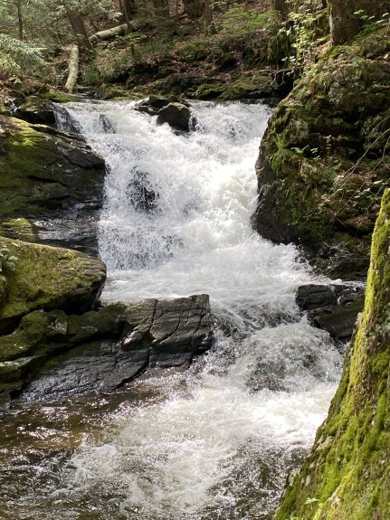
This falls is downstream from Shelving Rock Falls,
approximately half way between Shelving Rock Falls and where
the brook enters Lake George. According to topo maps, the
distance from Shelving Rock Falls to Lake George along the
creek is about 1100 feet. We are therefore
approximating the hike to be 550 feet, one-way.
This is a little challenging to get too. From
the base of Shelving Rock Falls, follow the trail that runs
along the river left side of the brook. There are downed
trees, parts of the path are narrow and steep, but for
anyone up for a challenge and somewhat in good shape you can
make it.
Once you arrive at the top of the falls,
the brook bends. Work your way around the bend,
downstream from the falls, then scramble down a short steep
embankment to get to the base of the falls. Total drop
12-15 feet. The area across the brook was beautiful too, a
few small tributaries and mossy.
This drop is about
30 yards upstream from where the Northern Tributary flows
into Shelving Rock Brook.
Shelving Rock Brook empties into Lake George. The water
from this then flows through La Chute into Lake Champlain.
The flow then goes north through Canada on the Richelieu River and
empties into the St. Lawrence River.
Last update: July 1, 2025
|