| Directions
Drive to the Putnam Pond Campground, 763 Putts Pond
Road, Ticonderoga, NY. Stop at the entrance gate
attendant booth to pay the day use fee. This is
waived if you are 65 years or older and a NYS Resident.
From the booth, drive straight ahead for about a half
mile. The road will eventually circle around to the left
and bring you into the day use parking lot.
|
| County: |
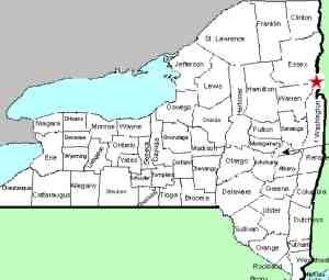
Essex |
| Town: |
Ticonderoga |
| USGS Map: |
Graphite |
| Waterway: |
Rock Pond Brook
Tributary |
| Latitude: |
N 43°
51'
04" |
| Longitude: |
W 73° 36'
08" |
| Drop: |
12' |
| Type: |
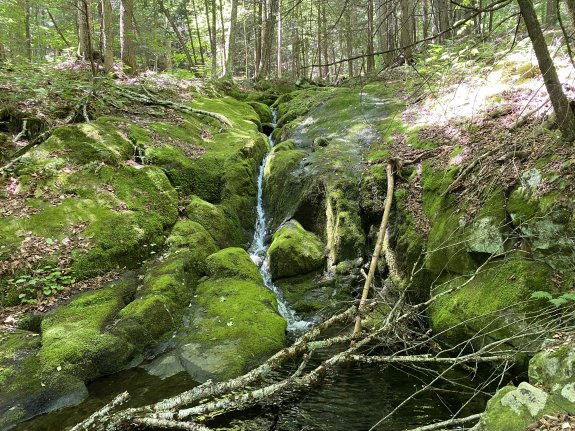
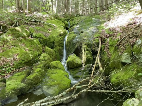
Ribbon
cascade |
| Region: |
Remote
area
east of the community of Ticonderoga |
| Parking: |
Unpaved parking
area |
| Trail type: |
Dirt |
| Length of
hike: |
7.9 mi
round-trip |
| Difficulty: |
Moderate
to vigorous |
| Accessibility: |
Public |
| Name: |
Unnamed |
|
We used AllTrails to research this hike.
Unfortunately, they do not have an existing hike to the
waterfalls, so we created our own route using AllTrails
maps. The route we took was a total of 7.9 miles with
850' of elevation. There are options but we really
liked the one we choose.
From the parking lot
you'll need to head north around the east side of Putnam
Pond and into the campground area. Walk along the road
to the beginning of the Clear Pond Trail, about half a
mile from the parking lot. Follow the Clear Pond Trail
until you are about 2.1 miles from the parking lot,
where it intersects the Rock Pond Trail. The Rock Pond
Trail is a big loop around Rock Pond.
We went
to the right to go along the north side of Rock Pond and
we are glad we did.. Once you reach the northeast
corner of Rock Pond (about 2.4 miles from the parking
lot) you will come upon an old mill site where they
mined and processed iron ore and graphite in the late
1800s to early 1900s. You will see a massive old rock
foundation and a cave used for water runoff from the
mine pit which is up above the foundation.
Continue on the trail along the north side of Rock Pond
which will offer many beautiful views of the pond. At
the western end of Rock Pond you will cross the outlet
of Rock Pond at 3.2 miles from the parking lot. Turn
right on the Rock Pond to Lilypad Pond Trail. In
approximately 2/10 of a mile (3.4 miles from the parking
lot) you may hear tumbling water off to your left. If
so, follow the sound for about 30 yards and you will see
the 12' Rock Pond Brook Tributary Falls.
If you
get to a point where the trail crosses the tributary
you went a little too far. This is a bonus falls on
your way to Woodland Falls.
After viewing the
falls, return to the trail and continue on the Woodland
Falls.
This tributary flows into Rock Pond Brook which flows into
Crane Pond. From there, it continues to Alder Pond which
flows into Alder Creek which joins Schroon River just north of
Schroon Lake near the community of Schroon Lake. This
waterway flows into the Hudon River when joins the Atlantic
Ocean in New York City.
Webmaster's note: Our thanks to Gary Dilmore for the pictures,
directions and information on this waterfall.
Last update: September 4, 2026
|