| Directions
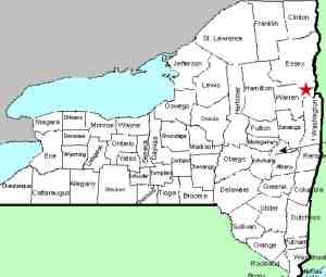
From I-87, exit 22, take NY 9N north toward Bolton Landing.
Six miles north of the village of Bolton Landing, the highway
will cross the Northwest Bay Brook. Just after crossing
the bridge, there is a parking area on the right.
|
| County: |
Warren |
| Town: |
Bolton |
| USGS Map: |
Silver Bay |
| Waterway: |
Northwest Bay Brook |
| Latitude: |
N 43° 37' 41" |
| Longitude: |
W 73° 36' 32" |
| Drop: |
15' |
| Type: |
Slide |
| Region: |
Off NY 9N north of Bolton Landing |
| Parking: |
Paved and unpaved lots |
| Trail type: |
Dirt |
| Length of hike: |
0.1 mile |
| Difficulty: |
Moderate |
| Accessibility: |
Public |
| Name: |
Unnamed |
|
 The parking area here holds a dozen or so cars
but it is very possible that it may be full when you visit.
Simply continue a little further along the highway and there is
a dirt road leading in to another parking lot. The parking area here holds a dozen or so cars
but it is very possible that it may be full when you visit.
Simply continue a little further along the highway and there is
a dirt road leading in to another parking lot. To reach the falls, there are two options. Continue back
down the highway on foot until you reach a trail on your left (the
same side of the road as both parking areas) leading in to a DEC
area. Directly across the road from here, the guardrails end.
In 2013, there was a beam moved to the side of the trailhead with
a stop sign on it. The trail will be quite evident.
You will come to the edge of the stream at the crest of the upper
falls. Although this route is easy to find and traverse, you
are at the edge of the crest of this waterfall so you can't fully
appreciate the plunge. Also, any view you may be able to get
of the lower falls is from above. Here, you are on the east
side of the brook.
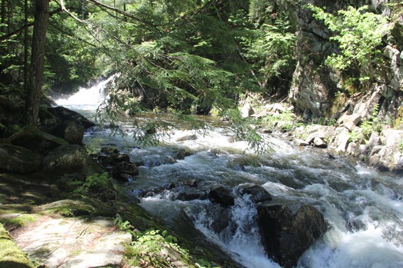
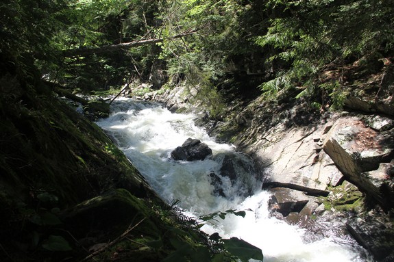
Option two will give you better views of the middle falls and
downstream views of the upper falls. The trade-off is in difficulty.
This trail, which is on the west side of the brook, is longer and
a bit more strenuous. Go back out to the highway and proceed
right to the bridge over the brook. After crossing the bridge,
across the road from the Northwest Bay Brook Fishing Access Site,
turn right and head into the woods. The trails here are not
definitive, but are passable. Go down the hill and then up
the steep embankment. When you reach the top, bear right,
keeping the brook in view and keep walking. You will eventually
come to the edge of the brook and, with a little investigating,
will find both the upper and middle falls.
The middle falls narrows into a flume as it slides through
the walls of the gorge here. It drops into a small pool at
its bottom.
The Northwest Bay Brook empties into Lake George.
The water from this then flows through La Chute in Ticondaroga and
ends up in Lake Champlain. The flow then goes north through
Canada on the Richelieu River and empties into the St. Lawrence
River.
Webmaster's note: For many years, we have listed this
area simply as Northwest Bay Brook Falls, indicating and an
upper and a lower section. We have recently become aware
that a third drop is present just downstream from this portion
so we have broken them down into the Upper, Middle and Lower
Falls.
Our thanks to Gary Dilmore for providing information on this
location.
Last update: August 23, 2026
|