| Directions
From NY 28 between Newport and Middleville,
find Castle Road/CR 7 which exits northeast. This
junction is just southeast of the West Canada Valley
High School campus. In about 1/2 mile on the left,
will be the Farrington Road. Park on the roadside
by the creek.
|
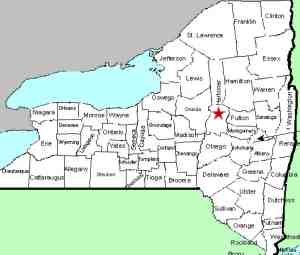
| County: |
Herkimer |
| Town: |
Fairfield |
| USGS Map: |
Middleville |
| Waterway: |
Wolf Hollow
Creek |
| Latitude: |
N 43°
09' 53" |
| Longitude: |
W 74°
58' 53" |
| Drop: |
15' |
| Type: |
Curtain Step |
| Region: |
Between Newport
and Middleville |
| Parking: |
Roadside |
| Trail type: |
Dirt |
| Length of
hike: |
0.1 mile |
| Difficulty: |
Easy |
| Accessibility: |
Public |
| Name: |
Unnamed |

|
 This unnamed waterfall
is located less than 1/4 mile upstream from the Old City Road Falls.
Clear views of the waterfall are available from the bridge on the
Farrington Road and less favorable views can be seen from the Castle
Road. The riverbanks are physically traversable, but there
are posted signs on your left as you view the falls and a barbed
wire fence on the right. This unnamed waterfall
is located less than 1/4 mile upstream from the Old City Road Falls.
Clear views of the waterfall are available from the bridge on the
Farrington Road and less favorable views can be seen from the Castle
Road. The riverbanks are physically traversable, but there
are posted signs on your left as you view the falls and a barbed
wire fence on the right.
The water from the Wolf Hollow Creek flows into the West Canada
Creek, then enters the Mohawk and Hudson Rivers before reaching
the Atlantic Ocean in New York City.
In a side-note about Wolf Hollow Creek, this is the name
assigned to this waterway by the USGS. The US Geological
Survey is the governmental agency that has the task of naming
all geological features: mountains, rivers, lakes, waterfalls
and so on. That means that this is the official name of
this waterway. The NYS DEC also refers to this stream as
the Wolf Hollow Creek. We have found, however, that
certain GPS devices, Garmin hiking units for example, use the
name City Brook. We don't know the source of this name,
but it is significant to note that this alternative terminology
is used.
Last update: October 7, 2017
|


