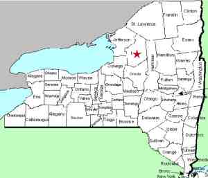
| Directions
From NY 12 just south of the BOCES center and just north
of the village of Glenfield, proceed west on the Glendale
Road, CR 32. About 0.6 of a mile up this road, just
before reaching the end of the Burke Road, you will cross
the Whetstone Creek. The waterfall can be seen upstream
from here, behind a private residence.
|
| County: |
Lewis |
| Town: |
Martinsburg |
| USGS Map: |
Glenfield |
| Waterway: |
Whetstone Creek |
| Latitude: |
N 43° 42' 59" |
| Longitude: |
W 75° 25' 06" |
| Drop: |
25' |
| Type: |
Step Tiered |
| Region: |
West of Glenfield |
| Parking: |
Roadside |
| Trail type: |
Roadside |
| Length of hike: |
Roadside |
| Difficulty: |
Roadside |
| Accessibility: |
Private |
| Name: |
Common |

|
 This waterfall has been known locally by this name for decades.
The name was derived from the fact that it is located on property
that was the Swan family farm for many years. The mailbox
here identifies the home as the residence of a Swan, so it is our
understanding that this is private property, so please honor that
fact. This waterfall has been known locally by this name for decades.
The name was derived from the fact that it is located on property
that was the Swan family farm for many years. The mailbox
here identifies the home as the residence of a Swan, so it is our
understanding that this is private property, so please honor that
fact.
Our pictures were all taken from the highway
right-of-way but a contributor has noted that the landowners
don't object to the public hiking up the riverbank in their
backyard to view the falls, as long as they are respectible.
The last photo in the array was sent in by a contributor.
It is a view of just the top drop with lower waterflow taken close-up to the stream.
The Whetstone Creek flows into the Black River, which flows to
Lake Ontario in Dexter, New York.
Last update: October 26, 2015
|


