| Directions
Heading south from Prospect on the
Trenton Falls Prospect Road, there is a road leading
into the old quarry just past the town library.
|
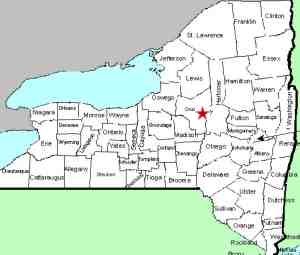
| County: |
Herkimer |
| Town: |
Russia |
| USGS Map: |
Remsen |
| Waterway: |
West Canada
Creek |
| Latitude: |
N 43°
18' 16" |
| Longitude: |
W 75°
08' 54" |
| Drop: |
15' |
| Type: |
Ribbon Cascade |
| Region: |
Southeast
of Remsen |
| Parking: |
Unpaved lot |
| Trail type: |
Dirt |
| Length of
hike: |
10-15 minutes |
| Difficulty: |
Easy |
| Accessibility: |
Private |
| Name: |
Unnamed |

|
We have been made aware
of this waterfall by a local contributor. An unnamed waterfall,
we started calling it this because of its access point. It is actually on the opposite side of the West
Canada Creek from the Prospect Quarry. Having said that,
in September 2017, we were notified that the road leading into
it is now posted so it appears that it is no longer accessible
via this route. Because of this, we have removed the specific access details..
This waterfall presents some unique circumstances. It
is technically not on the West Canada Creek. It's on a
stream feeding it. This stream isn't indicated on
topographical maps. Streams that are very small often
aren't noted on the maps. In this case, this "stream"
doesn't really exist! Whether it is a stream or a spring,
the source of this waterfall is underground. As the
pictures demonstrate, the waterfall emanates from about mid-way
down the side of this cliff. Consequently, although the
West Canada Creek is the county line, this waterfall is on the
Herkimer County bank.
Apparently in the past, locals would access this site from the
Herkimer County side. People were known to climb into the
chasm to a small hole in the rock face, which is the underground
source of this waterfall. Due to a number of factors, we would
not suggest this approach.
The West Canada Creek empties into the Mohawk River, which then
flows into the Hudson before reaching the Atlantic Ocean.
Last update: September 18, 2017
|


