| Directions
As you drive north from Canton on US 11, take a right
on NY 68. In about 9.3 miles, take a right on the
Orebed Road. In 3.3 miles, turn right on the
Selleck Road. In 3.8 miles, a dirt road, the Kyle
Road, will be on your left. In about 0.4 miles,
this waterfall will be on the far side of a pond on your
left.
|
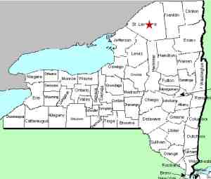
| County: |
St. Lawrence |
| Town: |
Pierrepont |
| USGS Map: |
West Pierrepont |
| Waterway: |
Van Rensselaer Creek |
| Latitude: |
N 44° 29' 12.68" |
| Longitude: |
W 75° 01' 46.61" |
| Drop: |
NA |
| Type: |
Ribbon cascade |
| Region: |
Southeast of Canton |
| Parking: |
NA |
| Trail type: |
NA |
| Length of hike: |
NA |
| Difficulty: |
NA |
| Accessibility: |
Private |
| Name: |
Unnamed |

|
We want to clarify a number of things. Our directions were
obtained through conversation with a
user on our Facebook page. We are very comfortable that
they are accurate, but we have not yet been to this location to
check them for specifics. For people coming from the south,
there is definitely a shorter route through Russell.
This is actually on a feeder, which is one of the sources of the
Van Rensselaer Creek.
It is our understanding that this
is on private property and can't be seen from this dirt road.
We are continuing to research access information and specifics
on the trail to it.
In the meantime, if anyone
recognizes this location from the picture, and has additional
information, please
contact us.
The Van Rensselaer
Creek flows into the Little River near its
source. This flows into the Grass River near Canton which
empties into the St. Lawrence River in Massena,
in St. Lawrence County.
Last update: March 15, 2016
|


