| Directions
In the hamlet of Paul Smiths, from the intersection
of NY 30 and 86 (Easy Street), go north on 30 for about
0.9 mile. Take the entrance to the Paul Smith's
College Visitors Interpretive Center. From behind
the Visitor Center, go south on Heron Marsh Trail for
about 0.4 mile. Continue straight where the trails
cross for another 0.4 mile. From the dam at the
outlet of Heron Marsh, the waterfall can be seen.
|
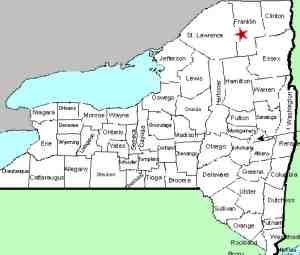
| County: |
Franklin |
| Town: |
Brighton |
| USGS Map: |
St. Regis Mt. |
| Waterway: |
Heron Marsh Outlet |
| Latitude: |
N 44° 26' 22" |
| Longitude: |
W 74° 15' 32" |
| Drop: |
10' |
| Type: |
Cascade |
| Region: |
East of the hamlet
of Paul Smiths |
| Parking: |
Parking lot |
| Trail type: |
Dirt |
| Length of hike: |
3/4 mile, one-way |
| Difficulty: |
Easy |
| Accessibility: |
Public |
| Name: |
Common |

|
This
pleasant cascade is a fairly easy stroll in the northern
Adirondacks. The trail starts on the property of Paul
Smith's College.
We have recently been made aware of this location and will
tentatively visit there in the spring of 2021.
If anyone has any additional information on this location, we
would very much like to hear from you. Please contact us.
This waterfall is formed at the outlet of Heron Marsh.
The water flows through Lower Saint Regis Lake and then westerly
where it forms the Saint Regis River. This 86 mile long
waterway empties into the St. Lawrence River. One-quarter
mile before it reaches the St. Lawrence, it becomes Riviere St.
Regis because it enters the French influenced region in the
province of Quebec, Canada.
Last update: October 20, 2020
|


