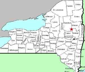
| Directions
On NY 30, 3.2 miles north of Northville, you will come to the junction
of CR 6. There are signs at the corner
indicating that this is the road to Benson.
Almost immediately after turning on this road,
the River Road will be on your right.
One-and-a-half miles down this road, the falls will be
visible cascading down the hillside on your
left.
|
| County: |
Hamilton |
| Town: |
Hope |
| USGS
Map: |
Hope
Falls |
| Waterway: |
Unnamed
stream |
| Latitude: |
N
43° 16' 25" |
| Longitude: |
W
74° 14' 09" |
| Drop: |
40'
|
| Type: |
Ribbon cascade |
| Region: |
Off
NY 30 between Northville and Wells |
| Parking: |
Roadside |
| Trail
type: |
Roadside |
| Length
of hike: |
Roadside |
| Difficulty: |
Easy |
| Accessibility: |
Private |
| Name: |
Unnamed |

|
 These falls, whose named we have based on its location, have
a significant drop in five or six steps, but other than during spring
run-off, the sight is not overly impressive due to the limited amount
of water flowing on this unnamed stream. These falls, whose named we have based on its location, have
a significant drop in five or six steps, but other than during spring
run-off, the sight is not overly impressive due to the limited amount
of water flowing on this unnamed stream.
There is also a question as to the town this waterfall is actually
in. The waterfall is only a few dozen feet west of the Sacandaga
River, on the town of Benson side. Our topographical map,
as well as a couple of others we found, show that the town line
is not the river and that this area on the west side of the river
is actually in the town of Hope. It is not clear, however,
that this "indefinite boundary" that is shown, is actually
the town line. Anyone reading this who might have more information
on this is encouraged to drop us an
email.
This unnamed stream flows into the Sacandaga River. This
flows through a number of lakes as it makes its way to the Hudson
River whose final destination is the Atlantic Ocean.
Last update: August 26, 2017
|


