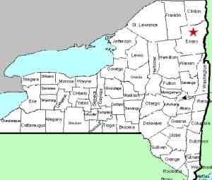
| Directions
Chapel Pond lies along the southwest of NY 73 between
the trailhead for Giant Mountain/Roaring Brook Falls and
the intersection of US 9.
|
| County: |
Essex |
| Town: |
Keene |
| USGS Map: |
Keene Valley |
| Waterway: |
Unnamed waterway |
| Latitude: |
N 44o 08' 18.73" |
| Longitude: |
W 73o 44' 56.26" |
| Drop: |
NA |
| Type: |
Ribbon cascade |
| Region: |
South of Keene |
| Parking: |
Roadside |
| Trail type: |
NA |
| Length of hike: |
NA |
| Difficulty: |
NA |
| Accessibility: |
Public |
| Name: |
Unnamed |

|
This contributor submitted waterfall may well be a
seasonal/rainy day waterfall. It is on the side of Round
Mountain which is the backdrop for Chapel Pond.
The waterway containing this waterfall empties into Chapel Pond.
The flow then continues down the Beede Brook and then
into the East Branch of the Ausable River. The East Branch
and the West Branch join forces downstream at Au Sable Forks to
form the Ausable River. This waterfall rich river empties
into Lake Champlain in the town of Peru.
Last update: July 31, 2015
|


