| Directions
We have not yet pin-pointed the location of this waterfall.
Information will be posted as soon as it is available.
|
| County: |
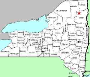
Essex |
| Town: |
Keene |
| USGS Map: |
Lake Placid |
| Waterway: |
Styles Brook |
| Latitude: |
N 44o 17' 48" |
| Longitude: |
W 73o 46' 44" |
| Drop: |
NA |
| Type: |
NA |
| Region: |
Off NY 9N between Keene and Upper Jay |
| Parking: |
NA |
| Trail type: |
NA |
| Length of hike: |
NA |
| Difficulty: |
NA |
| Accessibility: |
Private |
| Name: |
Common |

|
There are references on-line and in at least one printed
guide, but none of these sources indicate specifically where
this waterfall is. For quite some time now, we have had
this page indicating that we didn't know if the region was
public or private. On May 18, 2019, we received an email
from a contributor noting that it is privately owned.
The good news is that this contributor has a friend who is a
friend of the owner and they were able to access the site and
get pictures.
If anyone has any additional information on this location, please
feel free to contact us.
The Styles Brook flows into the East Branch of the Ausable River
between Keene and Upper Jay. This joins forces with the West
Branch in Ausable Forks. The combined Ausable River empties
into Lake Champlain in the town of Peru.
Last update: May 20, 2019
|


