| Directions
From NY 72 in the village of Parishville,
Catherine Street is the first intersection north of
the bridge over the St. Regis River. When you
leave the village, this becomes the Sylvan Falls Road.
In about 4.6 miles, you will come to the Jones Road
on your right. This waterfall will be in sight
upstream from the bridge there.
|
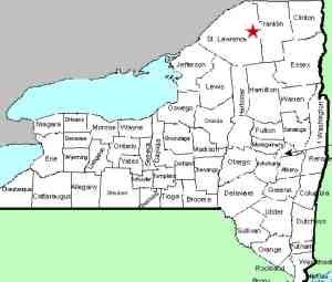
| County: |
St Lawrence |
| Town: |
Hopkinton |
| USGS Map: |
Sylvan Falls |
| Waterway: |
St. Regis
River West Branch |
| Latitude: |
N 44°
35' 52" |
| Longitude: |
W 74°
44' 14" |
| Drop: |
6' |
| Type: |
Curtain cascade |
| Region: |
Off NY 72
in the village of Parishville |
| Parking: |
Roadside |
| Trail type: |
NA |
| Length of
hike: |
NA |
| Difficulty: |
NA |
| Accessibility: |
Private |
| Name: |
Unnamed |

|
As you round the corner on the Jones Road, a seasonally maintained
road, you will see a bridge with a height barrier labeled as 7 feet.
You will also see posted signs on both sides of the road.
The land is this area is private but the road is public. Park
on the roadside and walk to the bridge. You will see this
waterfall about 400 feet upstream on your left.
This waterfall is unnamed and isn't noted on topographical maps.
We have given it this moniker for obvious reasons. It is on
the west branch of the St. Regis River, just upstream from where
the Jones Road crosses the river!
There is a large boulder sticking out of the stream about 1/3
the way across the channel on river right. The drop of this
estimated to be six feet but it difficult to gauge because of the
distance you are from it. Below the drop, the water babbles
down to the bridge and then on the downstream side of the bridge,
there is another ledge that drops the water another two feet or
so. Rapids follow that for a stretch.
The West Branch of the St. Regis River flows into the main channel
in Winthrop. The St. Regis River then flows to the St. Lawrence
River almost on the US/Canada border a few miles northeast of Massena,
New York.
Last update: October 10, 2016
|


