| Directions
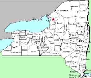
This waterfall is located on private property so it is not accessible.
|
| County: |
Jefferson |
| Town: |
Adams |
| USGS Map: |
Watertown |
| Waterway: |
Stony Creek |
| Latitude: |
N 43° 52' 33" |
| Longitude: |
W 75° 58' 48" |
| Drop: |
25' |
| Type: |
Two rectangular block falls |
| Region: |
South of Watertown |
| Parking: |
NA |
| Trail type: |
NA |
| Length of hike: |
NA |
| Difficulty: |
NA |
| Accessibility: |
Private |
| Name: |
Common |

|
 These
drops are on
private property so are not publicly accessible. Since
they are unnamed, we originally dubbed them Talcott
Lower Falls, since it is downstream from that popular named
waterfall. We were contacted by the property owner in June
2018 and found out that it is often referred to as Little
Talcott Falls. Since that time we have also discovered
that a series of six drops are located between these drops and
US 11. Those are referred to as Talcott Lower Falls. These
drops are on
private property so are not publicly accessible. Since
they are unnamed, we originally dubbed them Talcott
Lower Falls, since it is downstream from that popular named
waterfall. We were contacted by the property owner in June
2018 and found out that it is often referred to as Little
Talcott Falls. Since that time we have also discovered
that a series of six drops are located between these drops and
US 11. Those are referred to as Talcott Lower Falls.
There
are two drops here. Both
are probably best described as rectangular blocks. Since the
second descent is about 100' below the first one, we are going
to list them as two separate falls, Little Talcott Upper Falls
and Little Talcott Lower Falls. We
stress that this is on private property and will state that it
is not visible from a highway. That is not completely
accurate.
During the spring of the year before the
foliage arrives, distant views of this are possible from the
highway. Although there are places where both drops can be
seen, photo ops of them together could not be found. There
are just too many trees in the path. We were, however,
able to find a location within the highway right-of-way where we
could get shots of the lower drop.
Our first
picture is of the lower falls
from a relatively long distance with a fairly long lens and
through the trees. In addition, our vantage point was
shaded and the falls were in the sunshine so the resulting
pictures were not as good a quality as we would have liked!
The other photos are of the upper drop and were provided by the
owner.
The Stony Creek is actually one of the smallest waterways that
flows into Lake Ontario that contains a waterfall. Further
downstream, it flows through the village of Henderson. Its
outlet into Lake Ontario is just south of Stony Point in the town
of Henderson.
Last update: August 13, 2023
|


