| Directions
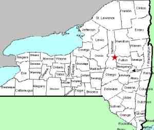
From Dolgeville, take NY 29 north. As you approach
the hamlet of Salisbury Center, look for the Kingsley
Road on your left. Take this and park on your right
just before the crossing the creek.
|
| County: |
Herkimer |
| Town: |
Salisbury |
| USGS Map: |
Salisbury |
| Waterway: |
Spruce Creek |
| Latitude: |
N 43° 08'
24" |
| Longitude: |
W 74° 47'
08" |
| Drop: |
10' |
| Type: |
Slide |
| Region: |
Northwest of Dolgeville |
| Parking: |
Roadside |
| Trail type: |
Dirt |
| Length of hike: |
3 minutes |
| Difficulty: |
Easy |
| Accessibility: |
Public |
| Name: |
Unnamed |

|
This area is just downstream
of the Spruce Creek Falls. It would probably be more correct
to give directions from there, since the covered bridge at that
location makes it a focal point. If you travel there first,
return to NY 29, take a right and then the first right onto Kingsley
Road. From here, you will also have upstream views of the
covered bridge and waterfall at Spruce Creek Falls.
The main part of this drop is a slide that drops an estimated
10'. There are two small steps just upstream of the bridge.
It would probably be a tough call as to whether that is the lower
part of the Spruce Creek Falls upstream or the top of this stretch.
Since the vantage points of these two locations are from different
roads, we have included it here.
You can find a trail across from the parking area, on the downstream
side of the bridge. From here, you can make your way to the
rocks below the falls for a nice view and picture opportunity.
The water from the Spruce Creek makes its way into the East Canada
Creek, the Mohawk River and the Hudson River before reaching the
Atlantic Ocean in New York City.
Last update: May 24, 2016
|


