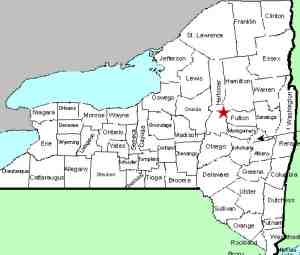
| Directions
From Dolgeville, take NY 29 north. Just before
the junction of NY 29A, take a left on Fairview Road.
Park in the lot on your left just before the covered bridge.
|
| County: |
Herkimer |
| Town: |
Salisbury |
| USGS Map: |
Salisbury |
| Waterway: |
Spruce Creek |
| Latitude: |
N 43° 08' 25" |
| Longitude: |
W 74°
47' 15" |
| Drop: |
12' |
| Type: |
Slide |
| Region: |
Northwest of Dolgeville |
| Parking: |
Unpaved lot |
| Trail type: |
Dirt |
| Length of hike: |
1 minute |
| Difficulty: |
Easy |
| Accessibility: |
Public |
| Name: |
Unnamed |

|
 In addition to the waterfall,
you are treated to an additional highlight here. There is
a 42' long covered bridge originally built in 1857. Now on
the historic register, it has been relocated here. According
to the New York State Covered Bridge Society there are 24 remaining
covered bridges in the state. We have determined that four
covered bridges in northern New York are located near waterfalls.
Spruce Creek Falls is home to the Salisbury Center Bridge.
Beecher
Falls in Edinburg, Jay
Falls in Jay and Lower Falls
in Essex County are the other three. In addition to the waterfall,
you are treated to an additional highlight here. There is
a 42' long covered bridge originally built in 1857. Now on
the historic register, it has been relocated here. According
to the New York State Covered Bridge Society there are 24 remaining
covered bridges in the state. We have determined that four
covered bridges in northern New York are located near waterfalls.
Spruce Creek Falls is home to the Salisbury Center Bridge.
Beecher
Falls in Edinburg, Jay
Falls in Jay and Lower Falls
in Essex County are the other three.
The facility also boasts a nice little park with picnic tables
and a second waterfall, less than 500' downstream. While we
were there, two members of the local highway department crew were
mowing and trimming. There were also two men downstream fishing.
This appears to be a popular spot locally.
Just above the covered bridge, there is a series of small drops
that go under the bridge. There are several other steps downstream
of the bridge, before reaching the main drop, which is a slide of
about 12'.
The water from the Spruce Creek makes its way into the East Canada
Creek, the Mohawk River and the Hudson River before reaching the
Atlantic Ocean in New York City.
Last update: October 7, 2017
|


