| Directions
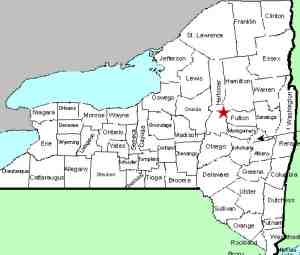
From Dolgeville, take the Military
Road northwest. In about 5 miles, bear right on
the Dairy Hill Road. The waterfall will be on
the right in a little over 1/4 mile.
|
| County: |
Herkimer |
| Town: |
Salisbury |
| USGS Map: |
Salisbury |
| Waterway: |
Spruce Creek |
| Latitude: |
N 43°
09' 23" |
| Longitude: |
W 74°
50' 41" |
| Drop: |
15' |
| Type: |
Curtain cascade |
| Region: |
Northwest
of Dolgeville |
| Parking: |
Roadside |
| Trail type: |
Dirt |
| Length of
hike: |
1 minute |
| Difficulty: |
Easy |
| Accessibility: |
Private |
| Name: |
Unnamed |

|
This is a pleasant little
waterfall not far off the highway. Please note that this area
is posted. You can get into a field just off the road before
reaching the posted area where you can view the falls.
This is a very pretty waterfall. Its overall height is
difficult to gauge. The bed of the creek here is what appears
to be a huge boulder. The top of the falls is a slide into
several cascades at different points across the width of the creek.
As mentioned, the area is posted, so we couldn't get very close,
but from the side of the road it could be seen that the area downstream
is significantly lower than the base of the falls that could be
seen. one could assume that there another drop that was out
of view.
There is another waterfall a short distance upstream that is
actually larger than this one. Access to that one is not available,
however. There are no public trails to get there.
The water from the Spruce Creek makes its way into the East Canada
Creek, the Mohawk River and the Hudson River before reaching the
Atlantic Ocean in New York City.
Last update: September 30, 2016
|


