| Directions
This location is best accessed by boat. From the
hamlet of Cranberry Lake, head due south on the lake.
Veer to the left (east) around Joe Indian Island and
then continue due south. As you enter South Bay,
Chair Rock Point is dead ahead. Steer to the right
around the point and go left into South Flow.
Trails at this point take you to the creek. |
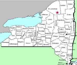
| County: |
St.
Lawrence |
| Town: |
Clifton |
| USGS Map: |
Newton Falls |
| Waterway: |
Sixmile
Creek |
| Latitude: |
N 44°
07' 50" |
| Longitude: |
W 74°
49' 40" |
| Drop: |
8' |
| Type: |
Slide |
| Region: |
South of
Cranberry Lake |
| Parking: |
NA |
| Trail type: |
Dirt trail
but water access is easier |
| Length of
hike: |
NA |
| Difficulty: |
NA |
| Accessibility: |
Public |
| Name: |
Common |

|
It is our understanding that you can also hike to this area
along a well maintained hiking path known as CL 50 Trail.
This is actually a combination of about nine connected trails
that goes around Cranberry Lake. It gets its name from the
fact that this is a 50 mile loop so realize that this is why a
boat is the best option.
We also have received
information that this is a very popular spot, especially for the
younger generation of locals, for tubing and swimming. Use
caution, our information also indicates that a number of
significant injuries have occurred over the years at this site.
It is apparently not uncommon for local rescue squads getting
called to the area.
After rounding the end of Chair Rock
Point, South Flow is the bay furthest back. Once entering
that, go to the extreme southern point of this bay. This
is the mouth of Sixmile Creek. The waterfall is not far up
that creek and can be accessed by the trail there.
Our pictures were provided by Google Earth. Our thanks to
the webmaster's nephew, Jim Laurin for his input.
Sixmile Creek flows into Cranberry Lake. This empties into the Oswegatchie River
which flows to the St. Lawrence River in Ogdensburg.
Last update: September 25, 2021
|


