| Directions
From the intersection of NY 58 and US 11 in the
village of Gouverneur, drive east toward Edwards.
In about 5.5 miles, the Southwest Technical Center BOCES
School will be on your left. Just past this, take
a right on the Farm To Market Road. In 3.2 miles,
take a sharp left onto the California Road. In
about 0.7 mile, take a right onto the Shantyville Road.
This waterfall is on the right in about 1.1 miles.
|
|
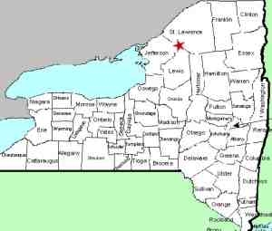
County: |
St. Lawrence |
|
Town: |
Fowler |
|
USGS Map: |
Lake Bonaparte |
|
Waterway: |
Sawyer Creek |
|
Latitude: |
N 44° 14' 56.88" |
|
Longitude: |
W 75° 27' 32.15" |
|
Drop: |
NA |
| Type: |
NA |
| Region: |
South
of the village of Gouverneur |
| Parking: |
NA |
| Trail
type: |
NA |
| Length
of hike: |
NA |
| Difficulty: |
NA |
| Accessibility: |
Private |
| Name: |
Unnamed |

|
We became aware of the existence of this waterfall from an
attendee at a presentation we made in August 2016. A
Gouverneur native told us of visiting this location when she was
young but couldn't remember specifics on it except that it was
off the California Road in the town of Fowler. This area
is just south of the village of Gouverneur. Additional
research, including a search through satellite maps, has made us fairly confident
that this waterfall is on the Sawyer Creek, just off the
Shantyville Road. On our last trip to the location, there
was a cable across the dirt road leading to the falls and posted
signs. We are attempting to contact the owner.
We are asking for help from anyone who may know this location.
If you have any knowledge about this waterfall, please
contact us.
Sawyer Creek flows into Matoon
Creek which empties into the Oswegatchie River just upstream of
Gouverneur. The Oswegatchie flows into the St. Lawrence
River in Ogdensburg.
Last update: October 29, 2016
|


