| Directions
It appears that the only access to this waterfall is
by canoe or kayak on the river.
|
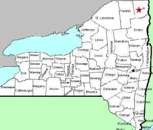
| County: |
Clinton |
| Town: |
Black Brook |
| USGS Map: |
Redford |
| Waterway: |
Saranac River |
| Latitude: |
N 44° 33'
34.62" |
| Longitude: |
W 73° 51'
22.57" |
| Drop: |
NA |
| Type: |
Curtain
cascade |
| Region: |
Southwest of Plattsburgh |
| Parking: |
NA |
| Trail type: |
NA |
| Length of hike: |
NA |
| Difficulty: |
NA |
| Accessibility: |
Private |
| Name: |
Common |

|
We visited this area in June
2015. Satellite images of the area of this waterfall show
that it is not far off the Silver Lake Road, Clinton County Route
1. There also appears to be a trail or road leading into the
area of it. We drove by this section and at the point where
we believed this road to be, it looked like a private driveway.
We have subsequently been in communication with members of the
whitewater community who have told us that efforts to get permission
to clean up the portage trail around this waterfall have not been
successful and "not particularly friendly." We have concluded
that unless you are personal friends with landowners in this area,
your only option is by water.
We do know that this waterfall splits around an island
The first two photos in our array show kayakers going over
this waterfall.
They were provided by Tony Shaw of Williston, Vermont. The
final image is courtesy of Bing Maps. If anyone else has any information on it, please
contact us.
The Saranac River empties into Lake Champlain just downstream
in the city of Plattsburgh.
Last update: April 19, 2016
|


