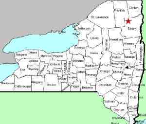
| Directions
I-87 crosses the Saranac River between exits 36 and
37. This waterfall is in sight from the Interstate
on the west side of the highway on the south-bound land.
There are two possible parking locations.
Specifics on that are in the text at the right.
|
| County: |
Clinton |
| Town: |
Plattsburgh |
| USGS Map: |
Plattsburgh |
| Waterway: |
Saranac River |
| Latitude: |
N 44° 40'
09" |
| Longitude: |
W 73° 29'
39" |
| Drop: |
NA |
| Type: |
Step cascade |
| Region: |
Off I-87 west
of the city of Plattsburgh |
| Parking: |
Roadside |
| Trail type: |
Dirt |
| Length of hike: |
0.5 mile,
one-way |
| Difficulty: |
Easy |
| Accessibility: |
Apparently
accessible |
| Name: |
Unnamed |

|
Parking 1 is on the east side of I-87. From Exit 36,
travel north on NY 22. The road will make a sweeping curve
to the right and will approach the north end of the old Air
Force Base.
Near the apex of this curve, on the river side, there is a
road/trail exiting the north side of the road. A short
distance down this trail, take a left and proceed under the
Interstate. Once under I-87 at the power plant fence, you
need to walk up by the freeway for the trail to continue.
On your way back to the parking spot, you may want to take a
left before returning to your vehicle. This is an
alternative route to the river where you will find a bonus drop.
This appears to be the remains of a former dam.
Parking 2 is on the west side of I-87. From the same
Interstate exit, go south on 22 a very short distance and take
CR 32 to the right. Follow this to the intersection of
Military Turnpike and take a right. As you approach the
Saranac River, there is parking and a trail along the river
takes you to these falls. Although this is a longer hike,
it is also the access to the
Saranac River Falls at Military
Road.
Our thanks to Kelly Magnuson for sending in these photos and
information.
The Saranac River flows into Lake Champlain in Plattsburgh.
Last update: May 8, 2020
|


