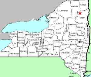
| Directions
Leave Plattsburgh west-bound on NY 3. Take a
left on Military Turnpike. In a short distance you
will cross the Saranac River. A hydro facility is
on the left.
|
| County: |
Clinton |
| Town: |
Schuyler
Falls/Plattsburgh |
| USGS Map: |
Morrisonville |
| Waterway: |
Saranac River |
| Latitude: |
N 44° 40'
10" |
| Longitude: |
W 73° 30'
28" |
| Drop: |
NA |
| Type: |
Dam |
| Region: |
Off NY 3 west
of the city of Plattsburgh |
| Parking: |
Unpaved lot |
| Trail type: |
NA |
| Length of hike: |
NA |
| Difficulty: |
NA |
| Accessibility: |
Private |
| Name: |
Unnamed |

|
This hydro-electric facility is run by ENEL. There
appear to be two, and possibly as many as four, nice waterfalls
below the dams here. The bad news is that this area is
posted and surrounded by chain link fences. From the
parking area, your view is limited and photo opportunities even
more limited.
We are using a Google Maps image below but Bing Maps show the
same thing. There is what appears to be a very nice plunge
in the lower center which would be on the Schuyler Falls side of
the river. In the upper right, there is a smaller drop
that would be on the Plattsburgh side. The town line runs
down the center of the river here. The river right side of
the dam would straddle the town line and the river left side
would be in Plattsburgh. Both of these might have a small
cascade below the dams during periods of higher waterflow or
when water is released during periods of non-production.
As mentioned, there really is no way, short of paddling up
the river from downstream, of getting decent photos of any of
these falls.
If anyone has any information on this
location, please feel free to
contact us.
The Saranac River flows into Lake Champlain in Plattsburgh.
Last update: May 9, 2016
|


