| Directions
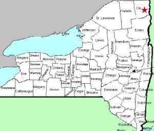
In the village of Cadyville, take Park Row off US 3.
At the end, take a right and cross the river and park in
the area on the right immediately after the bridge.
|
| County: |
Clinton |
| Town: |
Plattsburgh |
| USGS Map: |
Morrisonville |
| Waterway: |
Saranac River |
| Latitude: |
N 44° 41'
48" |
| Longitude: |
W 73°
37' 39" |
| Drop: |
30' |
| Type: |
Segmented
rectangular block |
| Region: |
West of Plattsburgh |
| Parking: |
Unpaved
lot |
| Trail type: |
Dirt |
| Length of
hike: |
0.6 mile,
one-way |
| Difficulty: |
Easy |
| Accessibility: |
Public |
| Name: |
Unnamed |

|
 At this parking area, there is an information kiosk telling about
the several hydro facilities in the area, operated by New York
State Gas and Electric Corp (NYSEG). If you walk about 0.6
mile down this road, you will reach the Cadyville Dam.
Because of its location, we have logged the very nice waterfall immediately below
it Cadyville Falls. At this parking area, there is an information kiosk telling about
the several hydro facilities in the area, operated by New York
State Gas and Electric Corp (NYSEG). If you walk about 0.6
mile down this road, you will reach the Cadyville Dam.
Because of its location, we have logged the very nice waterfall immediately below
it Cadyville Falls.
About 1/4 mile down this road, you will pass the Cadyville
Powerhouse. What we have dubbed Cadyville Lower Falls is
next to that. Also, as you drove down Park Row, you passed
an area where you were looking over the top of the Cadyville
Dam. Although you couldn't see it, you were right behind
the Cadyville Falls at that point.
We should also point out that the river through here is the
town line between Schuyler Falls and Plattsburg. However,
this waterfall is on the north side which is in the town of
Plattsburg.
The Saranac River empties into Lake Champlain just downstream
in the city of Plattsburgh.
Last update: May 9, 2016
|


