| Directions
Take NY 12 south from Watertown. Go south on CR
161, which is about 3.1 miles beyond the intersection of
the Plank Road in Burrville. At the end of this
road, take a right and then a quick left on Odell Road.
In 1.5 miles, take a right on Knapp Road, a seasonal,
unpaved road. At about 0.6 mile, go right on an
unnamed dirt road. Travel as far as you can.
The last 1000 feet or so will have to be traveled on
foot.
|
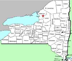
| County: |
Jefferson |
| Town: |
Rutland |
| USGS Map: |
Rutland
Center |
| Waterway: |
Sandy Creek |
| Latitude: |
N 43°
53' 40" |
| Longitude: |
W 75°
47' 32" |
| Drop: |
NA |
| Type: |
Multiple
drops |
| Region: |
Southeast
of Watertown |
| Parking: |
Dirt road |
| Trail type: |
Dirt |
| Length of
hike: |
1/4 mile ± |
| Difficulty: |
Easy |
| Accessibility: |
Public |
| Name: |
Common |

|
This
location has only recently been brought to our attention.
To the best of our knowledge, it is on state land, within the
Pinckney State Reforestation Area.
The information
provided here is tentative. We have a trip planned to this
area soon and will post more specifics at that time.
This
is a location not well known to anyone other than locals.
It is quite common to see ATVs when visiting here. The
easiest path near the end of the hike is in the stream-bed.
This is made more difficult when water is flowing heavily.
This waterfall is actually on an unnamed feeder of the Sandy
Creek. The feeder is a little over two miles long and this
drop is less than a mile from Sandy Creek. The Sandy Creek flows into Lake Ontario.
Last update: June 27, 2020
|


