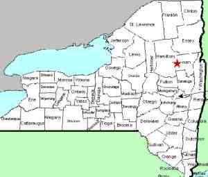
| Directions
From the junction of NY 8 and NY 30
north of Wells, go east on Route 8 for about 11.8 miles.
There is a parking area on the left. If
traveling from the east, this is 11.6 miles from the
intersection of NY 28 and NY 8 in Wevertown.
|
| County: |
Warren |
| Town: |
Johnsburg |
| USGS Map: |
Bakers Mills |
| Waterway: |
Sacandaga
River East Branch |
| Latitude: |
N 43°
34' 51" |
| Longitude: |
W 74°
07' 22" |
| Drop: |
8' |
| Type: |
Block |
| Region: |
NY 8 between
Wells and Bakers Mills |
| Parking: |
Unpaved parking
lot |
| Trail type: |
Dirt |
| Length of
hike: |
0.9 mile,
one-way |
| Difficulty: |
Moderate |
| Accessibility: |
Public |
| Name: |
Common |

|
Several on-line references to this location note that it requires fording the Sacandaga River so it is recommended
that it be done in the summer when it is dryer. Apparently
there have been some changes to the trail here so that is no
longer the case.
Just east of the parking area (to your right as you face it),
there is a trailhead. A hundred yards or so into
your hike, there is a barrier and the trail veers off to your
right. You will come to a small stream which you should
have no problem crossing. You will encounter yellow DEC
trail markers along this path.
On our first successful trip to this location, we walked
along the trail to the bank of the Sacandaga. Since we
were expecting to have to wade to the other side, we started up
the bank to find a suitable place to cross. Due to current
and other issues, we kept walking up the edge and soon began to
question the need to cross. We eventually reached the
waterfall without crossing the river.
After taking pictures, we discovered a trail that led back
downstream. It did climb up above the river level but we
kept the river in view. Before we knew it, we were back at
the point where we had crossed the small stream at the beginning
of our hike. Although it is not clearly marked, had we
been looking up the hill coming in, we would have seen this
trail. We believe that this is all DEC land and have a
call in to them to confirm this.
After we hear back from them, we will post an update.
The east branch of the Sacandaga River joins the main branch
downstream from that point. The Sacandaga River flows through
a number of lakes as it makes its way to the Hudson River whose
final destination is the Atlantic Ocean.
Last update: September 11, 2021
|


