| Directions
We have not yet been to this waterfall.
|
|
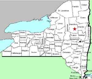
County: |
Hamilton |
|
Town: |
Wells |
|
USGS Map: |
Wells |
|
Waterway: |
Sacandaga River West Branch |
|
Latitude: |
N 43° 22' 37" |
|
Longitude: |
W 74° 28' 29" |
|
Drop: |
NA |
|
Type: |
NA |
|
Region: |
Off NY 30 between Northville and Wells |
|
Parking: |
Unpaved lot |
|
Trail type: |
Dirt |
|
Length of hike: |
2.5 miles, one-way |
|
Difficulty: |
NA |
|
Accessibility: |
Public |
|
Name: |
Unnamed |

|
We are planning a trip
to this waterfall. Our information on it are approximations.
This waterfall is in close proximity of another waterfall just upstream
and one on the Cold Brook which you pass coming in to this one.
The west branch of the Sacandaga River flows into the Sacandaga
River. The Sacandaga merges with the Hudson River in Lake
Luzerne. The Hudson empties into the Atlantic Ocean in New
York City.
Last update: September 6, 2016
|


