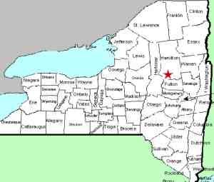
| Directions
From the junction of NY 8 and NY 10
south of Piseco Lake, take NY 10 south. You will
cross the Sacandaga several times. In the vicinity
of Chub Lake and Chub Lake Mountain, just north of one
of these crossings, there is a trail leading east from
the highway.
|
| County: |
Hamilton |
| Town: |
Arietta |
| USGS Map: |
Morehouse Mt |
| Waterway: |
Sacandaga River
West Branch |
| Latitude: |
N 43°
15' 10" |
| Longitude: |
W 74°
30' 49" |
| Drop: |
NA |
| Type: |
NA |
| Region: |
Southern
Hamilton County |
| Parking: |
NA |
| Trail
type: |
NA |
| Length
of hike: |
NA |
| Difficulty: |
NA |
| Accessibility: |
Unknown |
| Name: |
Common |

|
We have not yet been to
this location and haven't completely established the existence of
this waterfall. Topo maps label a "Falls" at this
location. At one time we were able to locate on-line sources
that named Arietta Falls but recent efforts to relocate those have
failed.
The directions in the side-bar are taken from a map, so their
accuracy has not been tested. The trail we have indicated
appears to go very close to the waterfall within 1300' from the
highway.
If anyone has information or pictures of this site, please
contact us.
The Sacandaga River flows through a number of lakes as it makes
its way to the Hudson River whose final destination is the Atlantic
Ocean.
Last update: August 26, 2016
|


