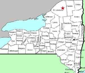
| Directions
Just east of the hamlet of South Colton, there is a
bridge across the Raquette River. Just east of this
there is an intersection where the Snell Road exits to
the upstream side. A very short distance up this, the
Raquette River Road follows the river upstream. A few
hundred feet from this junction, Stowe Lane, a dead-end
road, will be on the left.
|
| County: |
St. Lawrence |
| Town: |
Colton |
| USGS Map: |
Colton |
| Waterway: |
Raquette River |
| Latitude: |
N 44° 31'
00" |
| Longitude: |
W 74° 52'
55" |
| Drop: |
12' |
| Type: |
Segmented |
| Region: |
East of South
Colton |
| Parking: |
Roadside |
| Trail type: |
Dirt |
| Length of hike: |
0.25 mile |
| Difficulty: |
Easy
|
| Accessibility: |
Unsure |
| Name: |
Official |

|
This
three-part waterfall, hence the name, is located just below the base of the dam
at the bottom of South Colton Reservoir. The hamlet of
South Colton was originally named Three Falls, which got its
name before this, and several other power dams were built along
the Raquette River.
The coordinates given on the GNIS
data base are in line with the upper part of this stretch.
It is likely that the first of these three falls was where the
dam now stands.
Roughly 800 feet downstream of the
dam is a waterfall which we theorize was the "second" falls.
The third drop is another 1000 feet or so further down.
For several years, we have listed this lower drop as South
Colton Falls. This individual drop is still known locally
as this, but it is our belief that the three drops taken
together make up "Three Falls". The river drops an
estimated 90 feet over 1700 feet of this waterway.
From
the vantage point described in the directions side-bar, you can
see the bottom drop. The second row of pictures in our
photo array show this section.
In March 2019, we were contacted by a man from the Rochester
area who has a camp in St. Lawrence County and enjoys hiking and
exploring in the area. He provided us with pictures and a
map showing directions to access the location of the second of
Three Falls.
He has also provided us with this information ... "This site is also not the easiest to access but it's doable. It
is on hydro-co owned property, the only place they have the
posted signs are around a fenced in area near where the cars get
parked. I included a picture of how we get down there but it
does include a little bushwhacking to get there. There are 2
caution spots. First is ducking under the big pipe - there are
little 2-3 inch roundish stones on a slope that can roll out
from under you so you need to go slow, low and careful here.
Secondly, where you go into the bushwhacking part there are 12
inch small boulders on a slope and not secured. They've rolled
out on me before too. After the boulders you just break through
a 6 foot section of bushes and pop out into the open flat rock.
Sweet little area here and totally worth it every time I've
been. One last caution is at the falls all the way to the right.
There is a little 1 foot wide ledge that runs in front of them
that seems tempting to cross to get a better angle but this
section is terribly slippery and it's super easy to fall in. I
would go the 4 feet up and around to get to where you want to go
instead."
Now the disclaimer. We have visited this
location. There are Posted signs prominently displayed on
the fenced in area noting that it is owned by Brookfield Power.
Not finding others, you might reach the conclusion that the open
area is accessible. We urge you to use your judgement.
A visit to the DANC Internet Mapping Application showed that all
of the property surrounding the fenced in area is owned by Erie
Boulevard Hydropower which is affiliated with Brookfield Power.
We erred on the side of caution and chose not to enter the
property.
His pictures are shown in the first row of our array.
The final shot in the array shows his route in accessing the
second drop. That point is located roughly 600 yards
further up the Raquette River Road from where you turned on
Stowe Lane.
We are continuing to list a separate entry for South Colton Falls, number 3
of the Three Falls.
The Raquette River empties into the St. Lawrence River in Massena,
New York.
Last update: May 18, 2022
|


