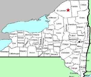
| Directions
This site is located on the Stark Road,
which is accessible from NY 56 between the hamlet of South
Colton and the intersection with NY 3 at Sevey Corners.
Although not one of the more remote areas of the Adirondacks,
this area is fairly distant from any sizable community.
Several miles from either end, the Stark Road is one of
the few paved roads that exits east from NY 56.
|
| County: |
St. Lawrence |
| Town: |
Colton |
| USGS Map: |
Stark |
| Waterway: |
Raquette River |
| Latitude: |
N 44° 27'
03" |
| Longitude: |
W 74°
45' 59" |
| Drop: |
20' |
| Type: |
Segmented |
| Region: |
Southeast of Colton |
| Parking: |
Roadside |
| Trail type: |
Roadside |
| Length of hike: |
Roadside |
| Difficulty: |
Easy |
| Accessibility: |
Public |
| Name: |
Official |

|
 Once on the Stark Road, you can't miss this location. Just
after passing the end of the Carry Falls Road, a bridge will cross
the Raquette River and the falls will be visible on the right.
There is parking on the shoulder of the road. A sign on a
metal gate at the entrance to an access road cautions you to stay
on the trail due to fluctuating river levels. You can view
these falls from this trail or from the highway by the bridge. Once on the Stark Road, you can't miss this location. Just
after passing the end of the Carry Falls Road, a bridge will cross
the Raquette River and the falls will be visible on the right.
There is parking on the shoulder of the road. A sign on a
metal gate at the entrance to an access road cautions you to stay
on the trail due to fluctuating river levels. You can view
these falls from this trail or from the highway by the bridge.
The dam at this site, operated by Brookfield Power, holds
back a region known as Stark Falls Reservoir. The facility at
this site, completed in 1957, was the last to be finished in the
Niagara Mohawk Power Corporation's Raquette River Power
Development Project.
As a result of our application, Stark Falls became the
official name of this waterfall on June 7, 2017.
The Raquette River empties into the St. Lawrence River in Massena,
New York.
Last update: July 1, 2017
|


