| Directions
Just east of the hamlet of South Colton,
there is a bridge across the Raquette River.
Just east of this there is an intersection where the
Snell Road exits to the upstream side. A very
short distance up this, the Raquette
River Road follows the river upstream. A few hundred
feet from this junction, Stowe Lane, a dead-end road,
will be on the left.
|
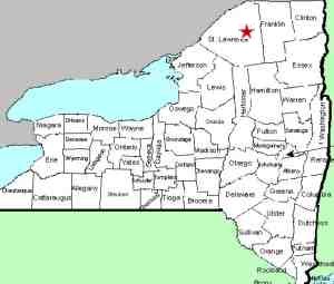
| County: |
St. Lawrence |
| Town: |
Colton |
| USGS Map: |
Colton |
| Waterway: |
Raquette River |
| Latitude: |
N 44° 30'
47" |
| Longitude: |
W 74°
53' 02" |
| Drop: |
20' |
| Type: |
Segmented |
| Region: |
Southeast of Colton |
| Parking: |
Roadside |
| Trail type: |
Roadside |
| Length of hike: |
Roadside |
| Difficulty: |
Easy |
| Accessibility: |
Public |
| Name: |
Common |

|
 There
is a parking area on Stowe Lane. From the riverbank, you
will have unobstructed views of the falls. The power dam at the hydro-electric plant at this site covers
one-half of the width of the river. On the other half, there
is the fifteen foot all South Colton Falls. There
is a parking area on Stowe Lane. From the riverbank, you
will have unobstructed views of the falls. The power dam at the hydro-electric plant at this site covers
one-half of the width of the river. On the other half, there
is the fifteen foot all South Colton Falls.
The dam at this site, built by the Niagara Mohawk Power Corporation
was completed in 1953. It holds back a region known as South
Colton Reservoir. You can't access the falls themselves from
this side of the river, but you can view them.
It is also our understanding that residents of this area have
called this "The Swimming Hole". The hamlet of South
Colton was originally known as Three Falls. It is our
theory that South Colton Falls is actually the third of the
falls that made up Three Falls. The first is most likely
the dam at the bottom of the South Colton Reservoir. The
second drop is between these two. For more, information,
please see our entry for
Three Falls.
The Raquette River empties into the St. Lawrence River in Massena,
New York.
Last update: May 18, 2022
|


