| Directions
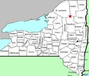
Just west of Tupper Lake. NY 3 crosses the Raquette
River. The entrance to this facility is
immediately west of the bridge.
|
| County: |
St. Lawrence |
| Town: |
Piercefield |
| USGS Map: |
Piercefield |
| Waterway: |
Raquette River |
| Latitude: |
N 44o
13' 59" |
| Longitude: |
W 74o
33' 54" |
| Drop: |
NA |
| Type: |
Dam |
| Region: |
West of Tupper
Lake |
| Parking: |
NA |
| Trail type: |
NA |
| Length of hike: |
NA |
| Difficulty: |
NA |
| Accessibility: |
Unknown |
| Name: |
Common |

|
There is a small waterfall at the base of this dam.
It is usually only flowing during very high run-off or perhaps
when electricity is not being produced.
The hydro facility is only about 1600' or so off the highway.
There really is not a good view of the downstream side because
the building is between the dam/falls and the parking area.
We have included a Bing Maps image of the area, but if anyone has any
additonal information or pictures of this location, please
contact us.
The Raquette River empties into the St. Lawrence River in Massena,
New York.
Last update: May 10, 2016
|


