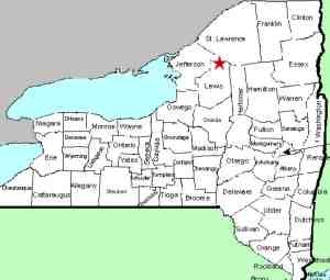
| Directions
As you enter Harrisville from the
west on NY 3, turn right on Main Street. Take the
second right which will take you out of the village.
This road ends in a "T". Take a left
and you are on the Middle Branch Road. At Middle Branch
Corners the road turns into Bryant
Bridge Road. As you continue down Bryant Bridge Rd you
will cross a bridge. This waterfall is upstream
from this location.
|
| County: |
Lewis |
| Town: |
Diana |
| USGS Map: |
Oswegatchie SW |
| Waterway: |
Oswegatchie River
Middle Branch |
| Latitude: |
N 44° 04' 03" |
| Longitude: |
W 75° 13' 21" |
| Drop: |
10' |
| Type: |
Curtain
cascade through steps |
| Region: |
South of Harrisville |
| Parking: |
Roadside |
| Trail type: |
Water access |
| Length of hike: |
1.2 mile,
one-way |
| Difficulty: |
Moderate |
| Accessibility: |
Private |
| Name: |
Common |

|
There are several waterfalls
in northern New York known as Rainbow Falls. In fact, it is
the second most common waterfall name in the region. This
particular waterfall is about 350 feet upstream from a commonly
named Rainbow Falls and is known locally as the upper falls.
It is not indicated on topographical maps but
is well known in the whitewater community. We have
confirmed that this
site is only accessible through private property.
There are hunting clubs on both sides of the river. That
is, of course, if you subscribe to the "one if by land"
approach. With a canoe or a kayak, or even walking up the
river during periods of low water, it can also be reached. This
is a DEC fishing access area, so access by water is permissable
if you carry a fishing pole (and license!).
The Middle Branch enters the West Branch of the Oswegatchie River
about a mile and a half south of Harrisville. This flows into the main
branch just west of the hamlet of Talcville in the town of Edwards.
The Oswegatchie River flows into the St. Lawrence River in Ogdensburg,
New York.
Last update: September 4, 2019
|


