| Directions
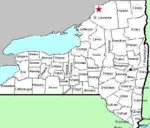
This location is In downtown Ogdensburg,
just upstream from where the Oswegatchie flows into
the St. Lawrence.
|
| County: |
St. Lawrence |
| Town: |
City of Ogdensburg |
| USGS Map: |
Ogdensburg
East |
| Waterway: |
Oswegatchie
River |
| Latitude: |
N 44°
41' 31" |
| Longitude: |
W 75°
29' 36" |
| Drop: |
NA |
| Type: |
Dam |
| Region: |
City of Ogdensburg |
| Parking: |
NA |
| Trail type: |
NA |
| Length of
hike: |
NA |
| Difficulty: |
NA |
| Accessibility: |
Unknown |
| Name: |
Unnamed |

|
We have not yet been able to establish the history of a waterfall
at this location. According to John Compo, a contributor,
the dam here was built in 1910.
If anyone has any information or pictures of this area before
the dam was built, please
contact us.
The Oswegatchie River flows to the St. Lawrence River just downstream
of this location.
Last update: March 23, 2023
|


