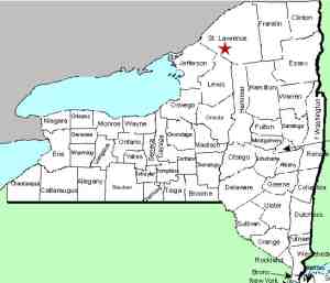
| Directions
From the intersection
of US 11 and NY 58 in the village of Gouverneur,
proceed east on Route 58 for a little over
5-1/2 miles. Shortly after passing
the South West Technical Center (BOCES school)
on your left, you will come to an intersection.
Take a left and then your first left from
this road, which is only about 0.1 mile
or so from NY 58. In 1.7 miles, the
road will take a sharp left and you will
go over a bridge.
|
| County: |
St. Lawrence |
| Town: |
Fowler |
| USGS Map: |
Edwards |
| Waterway: |
Oswegatchie River |
| Latitude: |
N 44°
17' 50" |
| Longitude: |
W 75°
22' 01" |
| Drop: |
~15' |
| Type: |
Cascade |
| Region: |
Southeast of Gouverneur |
| Parking: |
Roadside |
| Trail type: |
Roadside view |
| Length of hike: |
1 minute |
| Difficulty: |
Easy |
| Accessibility: |
Public |
| Name: |
Official |

|
The bridge at the Emeryville Falls and dam is a
throw-back to days gone by. It is a one-lane
span with a posted 5 MPH limit. The odds of
having to wait when you get there because there
is another vehicle crossing are slim. There
isn't much traffic in this area.
As you cross the bridge from the directions given,
there is a dam on your right and the falls will
be on your left. After crossing the bridge,
the road takes another sharp bend to the left and
you can find parking on the shoulder of the road.
From here it is quite easy to get down to the
river level.
The dam here has been in place for many years.
The power plant is just downstream, on the south
side of the river. To some people, the highlight
of this area is this old bridge. It is reminiscent
of a time when the pace of life was much slower.
As you drive over it, you can almost envision horse-drawn
carts and buggies of a century ago crossing this
span. Actually, there is a significant Amish
population not far from here and that probably does
occur from time to time.
As a result of our Waterfall Naming Project,
Emeryville Falls was added to the Geographic
Names Information System data base on April 19,
2019.
The Oswegatchie River flows into the St. Lawrence
River in Ogdensburg, New York.
Last update: April 23, 2019
|


