| Directions
on NY 28 in the village of Eagle Bay, Big Moose Road
will exit to the north. In a little under a mile
you will come to the trailhead parking lot on the right.
|
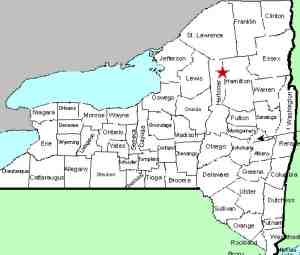
| County: |
Hamilton |
| Town: |
Inlet |
| USGS Map: |
Eagle Bay |
| Waterway: |
Cascade Lake Inlet |
| Latitude: |
43o 14' 41" |
| Longitude: |
74o 47' 5" |
| Drop: |
40' |
| Type: |
Ribbon cascade |
| Region: |
off NY 28 between Inlet and old Forge |
| Parking: |
Unpaved parking lot |
| Trail type: |
Dirt |
| Length of hike: |
2.6 miles, one-way |
| Difficulty: |
Moderate |
| Accessibility: |
Public |
| Name: |
Common |

|
We will start with a word of
caution about the trailhead parking lot. As you proceed
north on the Big Moose Road, you will round a curve to the
right. There is a sign on the left hand side of the road
indicating trailhead parking with an arrow to the right.
Because this is on a curve, it looks like it may be pointing
across the road to a small parking area large enough for maybe
three cars. This is not the trailhead parking lot although
we suspect you could access the trail from there. Continue
a short distance and you will come to the parking lot which will
easily accomodate ten cars.
From the parking lot continue
to the trailhead where you will find a registration kiosk.
A DEC facility, the trail is fairly well maintained but the
signage could be better. Less than 1/4 mile up this trail,
you will come to a "T". Take a left here and continue for
a little less than 1/2 mile. You will come to a "Y".
The sign here indicates that the falls is 2.5 miles further on
the trail to the right. The trail actually loops around
the lake so you could take either trail at this point, but the
one to the right is a bit shorter. Please note that the
mileage is inaccurate. The entire distance from the kiosk
to the falls is about 2.5 miles. At this intersection, you
have a little more than 1.5 miles to the falls.
You will
come to the clearing, shown in our last photo, that is about 100
feet across. The trail
continues across a small wooden bridge on the left at the back
side of the clearing. At this point, there are two trails
visible at the back right side of the clearing. Either of these
will take you to the falls and it is less than 200 feet away.
Since there are other signs on the trail, we aren't sure why
there isn't a sign at this point, but there wasn't when we were
there.
We will stress that there is no sign at this
clearing. We missed it and walked over 1/2 mile further.
Fortunately we ran into another hiking party that told us where
we should have gone. on our return to the clearing, we
encountered two other hiking parties that had done the same
thing we had.
At the waterfall, there as several rocks
where you can sit and have a snack if you brought one. In
fact, when we were there, there were at least six other parties
snacking, relaxing and taking pictures. You can get on the
rocks in the creek and go right to the base of the falls.
The trail also goes to the top where you can get an over the top
view.
Another fact about this area is that the parking
lot and the first half of the trail is in Herkimer County, but
the waterfall itself is in Hamilton.
As with many streams in this area, the waterway containing
this waterfall is shown on topographical maps but is
unnamed. It flows into Cascade Lake, continues to flow into
Moss Lake, and eventually joins the North Branch of the Moose River.
The water from here flows into the Middle Branch of the Moose River
at old Forge and then joins forces with the South Branch just northeast
of McKeever to become the Moose River. This continues into
the Black River in Lyons Falls which empties into Lake ontario near
Dexter in Jefferson County.
|


