| Directions
In downtown Amsterdam, drive north on NY 67/Church
Street and take a left on Forest Avenue. At its
end, turn right on Lyon Street and then left on Clizbe
Avenue. This will join Locust Avenue and near the
city limits, turn right on Pioneer Street.
|
| County: |
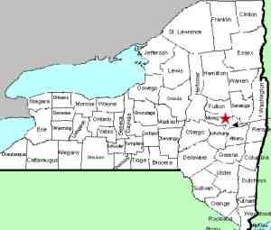
Montgomery |
| Town: |
City of Amsterdam |
| USGS Map: |
Amsterdam |
| Waterway: |
North Chuctanunda Creek |
| Latitude: |
N 42° 57' 50" |
| Longitude: |
W 74° 10' 04" |
| Drop: |
NA |
| Type: |
NA |
| Region: |
City of Amsterdam |
| Parking: |
NA |
| Trail type: |
NA |
| Length of hike: |
NA |
| Difficulty: |
NA |
| Accessibility: |
Private |
| Name: |
Unnamed |

|
This drop is below an old dam in an area that is fenced off with
no trespassing signs. It is not publicly accessible. The water from the North Chuctanunda Creek makes its way into
the Mohawk River and the Hudson River before reaching the Atlantic
Ocean in New York City.
Last update: November 8, 2017
|


