| Directions
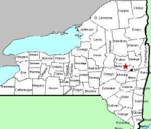
Hagaman is about a mile and a half north of Amsterdam.
Just north of the Pawling Street bridge there is a parking
lot on Mill Street near the intersection of those two streets.
|
| County: |
Montgomery |
| Town: |
Amsterdam |
| USGS Map: |
Amsterdam |
| Waterway: |
North Chuctanunda Creek |
| Latitude: |
N 42° 58' 33" |
| Longitude: |
W 74° 9' 5" |
| Drop: |
10' |
| Type: |
Dam |
| Region: |
North of the city of Amsterdam |
| Parking: |
Parking lot |
| Trail type: |
Dirt |
| Length of hike: |
0.1 mile |
| Difficulty: |
Easy |
| Accessibility: |
Public |
| Name: |
Common |

|
This fall is created by a dam next to an old mill
building. As the picture shows, there is a small waterfall
at the base of the dam. From the parking lot you can see the
falls. Note, please, that the banks of the creek are posted
so one shouldn't venture beyond the signs or into the creek itself
for a better view.
The water from the North Chuctanunda Creek
makes its way into the Mohawk River and the Hudson River before
reaching the Atlantic Ocean in New York City.
Last
update: February 8, 2016
|


