| Directions
At the intersection of NY 5 and NY 30 in downtown Amsterdam,
drive northeast on NY 30, Church Street. Church Street
will merge right and become NY 67. Turn onto Willow
Street and follow this to the end. Bear to the right
and park by the trees at the edge of this wide, unpaved
area.
|
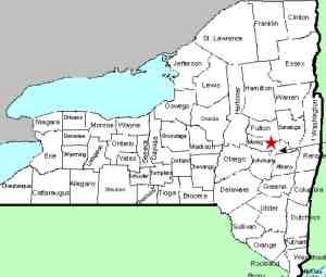
| County: |
Montgomery |
| Town: |
City of Amsterdam |
| USGS Map: |
Amsterdam |
| Waterway: |
North Chuctanunda Creek |
| Latitude: |
N 42° 56' 17" |
| Longitude: |
W 74° 10' 46" |
| Drop: |
10' |
| Type: |
Dam |
| Region: |
City of Amsterdam |
| Parking: |
Unpaved lot |
| Trail type: |
Dirt |
| Length of hike: |
1 minute |
| Difficulty: |
Easy |
| Accessibility: |
Public |
| Name: |
Unnamed |

|
There is a power dam at this location, but there
is still a nice waterfall at the base of it. At the end of
Willow Street, there's a short path to where one can see the falls.
Although it is a fairly good view at this point, photo opportunities
may be limited. Even in May the foliage gets very thick here.
If you want to see the creek clearly, your best bet is for early
spring or late fall.
The water from the North Chuctanunda Creek makes its way into
the Mohawk River and the Hudson River before reaching the Atlantic
Ocean in New York City.
Last update: February 5, 2016
|


