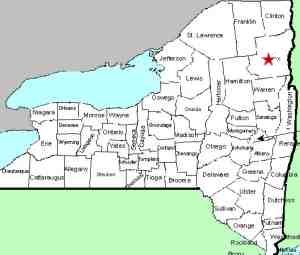
| Directions
We are working on clarifying access information for this
location.
|
| County: |
Essex |
| Town: |
North Hudson |
| USGS Map: |
Mt Marcy |
| Waterway: |
Niagara Brook |
| Latitude: |
N 44° 0' 40" |
| Longitude: |
W 73° 46' 12" |
| Drop: |
NA |
| Type: |
NA |
| Region: |
NY 9, northwest of North Hudson |
| Parking: |
NA |
| Trail type: |
NA |
| Length of hike: |
NA |
| Difficulty: |
NA |
| Accessibility: |
Unknown |
| Name: |
Unnamed |

|
It is not uncommon that more than one waterfall
might share a name. This is not the famous Niagara Falls! Information we
originally had on this waterfall
was actually for another falls that is very close to this one.
As a result, we are back to square one on this one.
Also known as Niagara Brook Falls, the coordinates we found appear
to be in a fairly level area that might actually be somewhat of
a swamp. That doesn't mean there can't be a waterfall there,
but it does make one wonder if there is. We are appealing
to hikers that may be familiar with this region. This is a
fairly remote area of Essex County where only the die-hard hiker
would go. If anyone has any pictures or information on this
waterfall, we would be very interested in
hearing from
you.
Niagara Brook flows into The Branch which empties into the Schroon
River, just southwest of the hamlet of North Hudson. The Schroon
flows through Schroon Lake and then continues its journey to the
Hudson River just outside of the village of Warrensburg. The
Hudson flows into the Atlantic Ocean in New York City.
Last update: January 30, 2016
|


