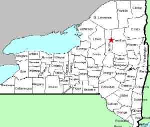
| Directions
From NY 12 at Alder Creek, follow NY 28 north.
After Otter Lake and just before crossing the Moose
River, take a right on McKeever Road. Bear right
on the Wolf Lake Landing Road and the old train station
will be on your right.
This is a gravel road and soon crosses railroad tracks.
In 1/2 mile from NY 28, you will reach the McKeever
Parking Area. From here, there are two dirt roads.
Take the one on the right. Drive for 3.2 miles to
the parking area on the left for the Remsen Falls Trail.
|
| County: |
Herkimer |
| Town: |
Webb |
| USGS Map: |
Thendara |
| Waterway: |
Moose River South Branch |
| Latitude: |
43° 37' 37" |
| Longitude: |
75° 02' 11" |
| Drop: |
3' |
| Type: |
Ledge |
| Region: |
Off NY 28 east of McKeever |
| Parking: |
Dirt roadside |
| Trail type: |
Dirt |
| Length of hike: |
0.5 mile, one-way |
| Difficulty: |
Easy |
| Accessibility: |
Public |
| Name: |
Common |

|
 Our
first comment about this location is that we have been there
when the gate at the McKeever parking area was closed and
locked. If this is the case, the hike is considerably
further, 3.7 miles versus 0.5 mile. The road is well
maintained but very narrow. On our trip there in August
2019, we were concerned that we would have a problem if we met
someone. We did! Another truck was on its way out as
we were on our way in. Fortunately, we didn't have to back
up far to find a place to pull over to let them by. If you
do meet someone and you are driving a sedan or other 2-wheel
drive vehicle, this could present a problem. On another
note, a bicycle could probably be used on this part of the
trail. Our
first comment about this location is that we have been there
when the gate at the McKeever parking area was closed and
locked. If this is the case, the hike is considerably
further, 3.7 miles versus 0.5 mile. The road is well
maintained but very narrow. On our trip there in August
2019, we were concerned that we would have a problem if we met
someone. We did! Another truck was on its way out as
we were on our way in. Fortunately, we didn't have to back
up far to find a place to pull over to let them by. If you
do meet someone and you are driving a sedan or other 2-wheel
drive vehicle, this could present a problem. On another
note, a bicycle could probably be used on this part of the
trail.
When you do reach the parking area, there is a gate. Please note that
access for the disabled is available by contacting the DEC for
the combination on the lock. This is a nice feature but
note that the remainder of the trail is a long way from what we
could consider handicapped accessible.
This is a fairly easy and short hike. One on-line source we found noted that it was all downhill.
Contrary to the stories your father told you, it will be uphill
on the way out! A sign at the parking area noted 0.6
mile. A short distance in another sign said 0.5 mile.
Our GPS record showed the entire hike to be more in the
neighborhood of just under 0.5 mile.
This waterfall is
not very large by any standard. It is categorically a
waterfall, just a very small one. That is why we have
called it a ledge falls. It drops about a foot and then a
few feet later, there is a second drop of about two feet.The south branch of the Moose River joins the middle branch just
northeast of McKeever to become the Moose River. This continues
into the Black River in Lyons Falls which empties into Lake Ontario
near Dexter in Jefferson County.
Last update: August 23, 2019
|


