| Directions
To get to here, travel NY 12 to Lyons Falls.
Find the bridge crossing the Black River and continue on
the Lyonsdale Road. Shortly after the Lyonsdale Road
becomes the Marmon Road, the Hunkins Road will be on the
left. This ends in a "T" on the Fowlerville
Road. Go left and you will shortly cross the Fowlerville
Bridge.
|
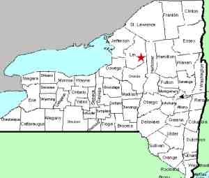
| County: |
Lewis |
| Town: |
Lyonsdale |
| USGS Map: |
Port Leyden |
| Waterway: |
Moose River |
| Latitude: |
N 43° 37' 24" |
| Longitude: |
W 75° 17' 4" |
| Drop: |
NA |
| Type: |
Rapids |
| Region: |
East of Lyons Falls |
| Parking: |
Roadside |
| Trail type: |
Dirt |
| Length of hike: |
20 minutes |
| Difficulty: |
Moderate |
| Accessibility: |
Unknown |
| Name: |
Common |

|
This location has been named by the whitewater community that
is very active on this stretch of river. This particular site
is about 1/2 mile downstream of the Fowlerville Falls. It
is not the 5' ledge just below Fowlerville Falls (which we have
dubbed Fowlerville Lower Falls),
but downstream of that and around the corner.
The funnel is actually a section of rapids that covers a considerable
stretch of the river. Rather than pictures, we have provided
a Bing Maps image to give you an idea of this area. The name
comes from the fact that the beginning of this section covers a
wider spot in the river and by the end it has narrowed, similar
to the shape of a funnel. It is very possible that the drop
we called Fowlerville Lower Falls may actually be the beginning
of the Funnel.
The Moose River flows into the Black River just a few miles downstream
from this location in Lyons Falls. The Black empties into
Lake Ontario in the Jefferson County community of Dexter.
Last update: November 28, 2015
|


