| Directions
To get to Agers Falls, travel NY 12 to Lyons Falls.
Find the bridge crossing the Black River and continue.
This becomes the Lyonsdale Road. Agers Falls is located
in the Agers Fall's Recreational & Historical Area,
which will be on your left a few miles up this road.
You can't miss it. For those techies with a GPS, the
911 address is 7757 Lyonsdale Road in Lyons Falls, New York.
Go left after entering the area and the road will take you
to a parking lot within view of the falls.
|
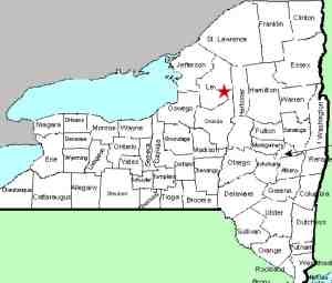
| County: |
Lewis |
| Town: |
Lyonsdale |
| USGS Map: |
Port Leyden |
| Waterway: |
Moose River |
| Latitude: |
N 43° 37' 22" |
| Longitude: |
W 75° 18' 54" |
| Drop: |
8' |
| Type: |
Rapids |
| Region: |
East of Lyons Falls |
| Parking: |
Unpaved lot |
| Trail type: |
Dirt/rock |
| Length of hike: |
10 minutes |
| Difficulty: |
Easy |
| Accessibility: |
Public |
| Name: |
Unnamed |

|
There are no less than a dozen drops and stretches of rapids
on the Bottom and Lower Moose. Although none of them are officially
named, the whitewater community has attached monikers to many.
This particular area is not labeled. It is, however, a very
pleasant portion of the river.
Just below Agers Falls, the river calms for a short distance.
Then it breaks to the right where it goes around a couple of small
islands which are nothing more than a few boulders, a bit of soil
and a few trees of varying sizes. At the islands there
are some slides and small plunges before leveling out for a short
distance, where there is another drop.
You can reach this area by proceeding downstream from the parking
area at Agers, which is the eastern-most portion of the Moose River
Hiking Trail. Early in the season, the entry to this trail
may well be very wet so proper footwear may be in order.
The Moose River flows into the Black River just a few miles downstream
from this location in Lyons Falls. The Black empties into
Lake Ontario in the Jefferson County community of Dexter.
Last update: November 23, 2015
|


