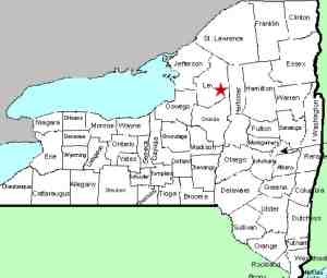
| Directions
To get to Agers Falls, travel NY 12 to Lyons Falls.
Find the bridge crossing the Black River and continue.
This becomes the Lyonsdale Road. Agers Falls is located
in the Agers Fall's Recreational & Historical Area,
which will be on your left a few miles up this road.
You can't miss it. For those techies with a GPS, the
911 address is 7757 Lyonsdale Road in Lyons Falls, New York.
Go left after entering the area and the road will take you
to a parking lot within view of the falls.
|
| County: |
Lewis |
| Town: |
Lyonsdale |
| USGS Map: |
Port Leyden |
| Waterway: |
Moose River |
| Latitude: |
N 43° 37' 18" |
| Longitude: |
W 75° 18' 45" |
| Drop: |
18' |
| Type: |
Rectangular Cascade |
| Region: |
East of Lyons Falls |
| Parking: |
Unpaved lot |
| Trail type: |
Dirt |
| Length of hike: |
2 minutes |
| Accessibility: |
Public |
| Name: |
Official |

|
 This area is promoted as the site of an "early American
industrial complex which included a rag paper mill, sawmill, workers'
houses, mill owner's house and family cemetery". This area is promoted as the site of an "early American
industrial complex which included a rag paper mill, sawmill, workers'
houses, mill owner's house and family cemetery".
The area and falls are named after Joel W. Ager who, according
to a sign in the area, was born in 1820 in Warren, New Hampshire.
Trained as a papermaker in New England, he came to Lewis County
in the 1840s looking for a place to locate a new paper mill.
He built his home here so that he could watch over the operations
of the mill he built near these falls. The home was a "two
story, center hall, frame structure". An addition on
the back of it "included a summer kitchen, wood shed, and the
unusual luxury, a two story privy"! The home was abandoned
in the 1930s and torn down in 1960.
Another sign at this location tells that the water powered sawmill
was constructed in 1871, "at the height of the New York State
timber industry". Its capital investment is listed as
$4,000 in 1880 and it employed three men at $1.50 per ten hour day.
The mill had two circular saws and it operated four months of the
year. It was in operation until it burned in 1902.
We are pleased to announce that we received an email on May 30,
2017, notifying us that our application had been approved by the
US Board on Geographic Names, and the name of this waterfall has
been added to the Geographic Names Information System (GNIS).
The Moose River flows into the Black River just a few miles downstream
from this location in Lyons Falls. The Black empties into
Lake Ontario in the Jefferson County community of Dexter.
Last update: May 30, 2017
|


