| Directions
From Cohoes to the west or Troy to the east, take NY 470
onto Van Schaick Island. Turn north on Park Avenue.
This waterfall can be accessed from this area.
|
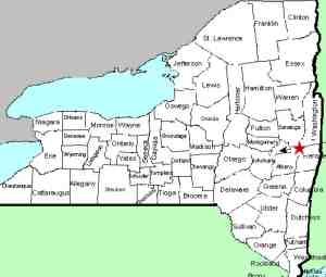
| County: |
Saratoga/Albany |
| Town: |
Waterford/Cohoes |
| USGS Map: |
Troy North |
| Waterway: |
Mohawk River |
| Latitude: |
N 42° 46' 33" |
| Longitude: |
W 73° 41' 16" |
| Drop: |
10' |
| Type: |
Curtain Cascade |
| Region: |
City of Cohoes |
| Parking: |
Streetside |
| Trail type: |
Dirt |
| Length of hike: |
5 minutes |
| Difficulty: |
Easy |
| Accessibility: |
Public |
| Name: |
Official |

|
At the end of Park, at the intersection
with Gansevoort, there's a fence with a wide driveway. Off
the driveway is a faint path that leads between a building surrounded
by a fence with 'posted' signs on the fence and a broadcast tower
with the same arrangement. The path looks like a community
trail used by practice and is not posted. Follow the trail
past the building and look to your left. There's a narrow
finger of shale projecting into the river. The falls are upstream
from that. Use care walking out onto the shale as the drops
to the river are about 50 feet or so.
One feature below the
falls is a swirling pool about 100 feet in diameter that for some
reason had carved away the bank, creating a sheer cliff at the river
bank but leaving for some reason the 'finger' projecting out into
the river. It gives an almost ideal platform from which to
photograph the falls.
The Mohawk merges with the Hudson River and then continues to flow into the
Atlantic Ocean in New York City.
Last update: August 26, 2017
|


