| Directions
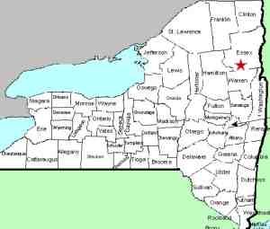
Just east of I-87, at exit 26, the Olmstedville Road
exits northwest from US 9. Follow this into Essex County
and when you cross the bridge in Olmstedville, the dam and
falls will be on the left and a parking area is just beyond.
|
| County: |
Essex |
| Town: |
Minerva |
| USGS Map: |
Schroon Lake |
| Waterway: |
Minerva Stream |
| Latitude: |
N 43° 46' 24" |
| Longitude: |
W 73° 55' 58" |
| Drop: |
5' |
| Type: |
Slide |
| Region: |
West of Schroon Lake |
| Parking: |
Unpaved lot |
| Trail type: |
Roadside |
| Length of hike: |
1 minute |
| Difficulty: |
Easy |
| Accessibility: |
Public |
| Name: |
Unnamed |

|
There is a dam about four or five feet tall here, with a slide
waterfall at its base of about the same height. It doesn't
appear that the dam is used for hydro-electric purposes.
According to a plaque at the kiosk in the parking area, mills
have operated at this location since 1804 and the first dam was
built in 1815. In 1879 a new dam, Lavery Dam, was built at
this location. Another interesting item noted on this plaque
is that Thompson Barnes, the fourth owner of the site, lived in
three centuries ... December 17, 1799 to October 17, 1901!
The Minerva Stream flows into the Trout Brook, which then flows
into the Schroon River just south of Pottersville and Schroon Lake.
This then empties into the Hudson River just south of Warrensburg.
The Hudson flows into the Atlantic Ocean in New York City.
Last update: November 20, 2015
|


